| Matsiatra | |
|---|---|
 Matsiatra | |
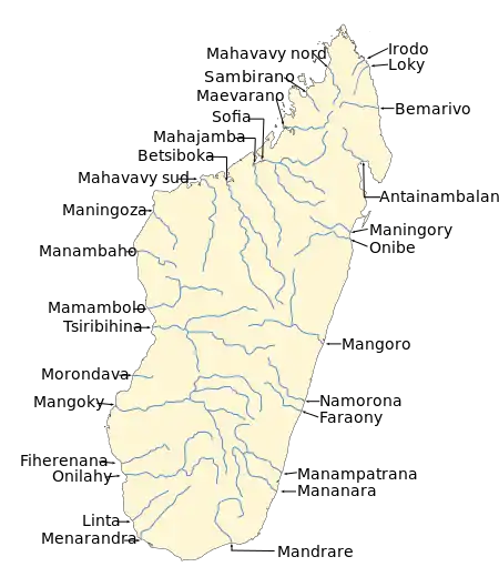 Map of Malagasy rivers. | |
| Location | |
| Country | Madagascar |
| Region | Haute Matsiatra |
| Physical characteristics | |
| Source | |
| • elevation | 1250 m |
| Mouth | Mangoky River |
• coordinates | 21°26′00″S 45°34′00″E / 21.43333°S 45.56667°E |
| Length | 410 km (250 mi) |
| Basin size | 13370 km2 |
| Basin features | |
| Progression | Iovolo, Fitampito |
| River system | Mangoky River |
| Tributaries | |
| • right | Manantsahala' Mitody, Manambaroa, Imatandika, Manandriana, Fanindrona |
The Matsiatra is a river in Haute Matsiatra region, is located in central and western Madagascar. It flows into the Mangoky River.[1]
Together with the Mananantanana, it forms the Mangoky River.
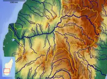
Mangoky Bassin
References
This article is issued from Wikipedia. The text is licensed under Creative Commons - Attribution - Sharealike. Additional terms may apply for the media files.