Balaruc-le-Vieux | |
|---|---|
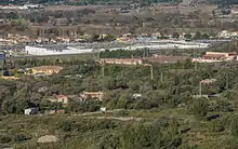
 View of Balaruc-le-Vieux across the Étang de Thau | |
.svg.png.webp) Coat of arms | |
Location of Balaruc-le-Vieux | |
 Balaruc-le-Vieux  Balaruc-le-Vieux | |
| Coordinates: 43°27′41″N 3°41′07″E / 43.4614°N 3.6853°E | |
| Country | France |
| Region | Occitania |
| Department | Hérault |
| Arrondissement | Montpellier |
| Canton | Frontignan |
| Intercommunality | CA Sète Agglopôle Méditerranée |
| Government | |
| • Mayor (2020–2026) | Norbert Chaplin[1] |
| Area 1 | 5.92 km2 (2.29 sq mi) |
| Population | 2,719 |
| • Density | 460/km2 (1,200/sq mi) |
| Time zone | UTC+01:00 (CET) |
| • Summer (DST) | UTC+02:00 (CEST) |
| INSEE/Postal code | 34024 /34540 |
| Elevation | 0–196 m (0–643 ft) (avg. 12 m or 39 ft) |
| 1 French Land Register data, which excludes lakes, ponds, glaciers > 1 km2 (0.386 sq mi or 247 acres) and river estuaries. | |
Balaruc-le-Vieux (French pronunciation: [balaʁyk lə vjø]; Occitan: Balaruc Vièlh) is a commune in the Hérault department in the Occitanie region in southern France.
Population
| Year | Pop. | ±% p.a. |
|---|---|---|
| 1968 | 533 | — |
| 1975 | 521 | −0.32% |
| 1982 | 701 | +4.33% |
| 1990 | 1,065 | +5.37% |
| 1999 | 1,802 | +6.02% |
| 2007 | 2,031 | +1.51% |
| 2012 | 2,234 | +1.92% |
| 2017 | 2,628 | +3.30% |
| Source: INSEE[3] | ||

Map
The shopping mall from the Southeast.
See also
References
- ↑ "Répertoire national des élus: les maires" (in French). data.gouv.fr, Plateforme ouverte des données publiques françaises. 13 September 2022.
- ↑ "Populations légales 2021". The National Institute of Statistics and Economic Studies. 28 December 2023.
- ↑ Population en historique depuis 1968, INSEE
Wikimedia Commons has media related to Balaruc-le-Vieux.
This article is issued from Wikipedia. The text is licensed under Creative Commons - Attribution - Sharealike. Additional terms may apply for the media files.