Gabian | |
|---|---|
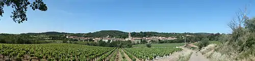
 View of Gabian | |
.svg.png.webp) Coat of arms | |
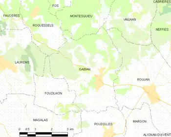
Location of Gabian | |
 Gabian  Gabian | |
| Coordinates: 43°30′52″N 3°16′25″E / 43.5144°N 3.2736°E | |
| Country | France |
| Region | Occitania |
| Department | Hérault |
| Arrondissement | Béziers |
| Canton | Cazouls-lès-Béziers |
| Intercommunality | Les Avant-Monts |
| Government | |
| • Mayor (2020–2026) | Francis Boutes[1] |
| Area 1 | 15.96 km2 (6.16 sq mi) |
| Population | 843 |
| • Density | 53/km2 (140/sq mi) |
| Time zone | UTC+01:00 (CET) |
| • Summer (DST) | UTC+02:00 (CEST) |
| INSEE/Postal code | 34109 /34320 |
| Elevation | 82–260 m (269–853 ft) (avg. 121 m or 397 ft) |
| 1 French Land Register data, which excludes lakes, ponds, glaciers > 1 km2 (0.386 sq mi or 247 acres) and river estuaries. | |
Gabian (French pronunciation: [ɡabjɑ̃]) is a commune in the Hérault département in Occitanie in southern France.
Map
Population
| Year | Pop. | ±% p.a. |
|---|---|---|
| 1968 | 780 | — |
| 1975 | 743 | −0.69% |
| 1982 | 640 | −2.11% |
| 1990 | 651 | +0.21% |
| 1999 | 659 | +0.14% |
| 2007 | 786 | +2.23% |
| 2012 | 827 | +1.02% |
| 2017 | 841 | +0.34% |
| Source: INSEE[3] | ||
Panorama
See also
References
- ↑ "Répertoire national des élus: les maires". data.gouv.fr, Plateforme ouverte des données publiques françaises (in French). 2 December 2020.
- ↑ "Populations légales 2021". The National Institute of Statistics and Economic Studies. 28 December 2023.
- ↑ Population en historique depuis 1968, INSEE
Wikimedia Commons has media related to Gabian.
This article is issued from Wikipedia. The text is licensed under Creative Commons - Attribution - Sharealike. Additional terms may apply for the media files.