Campagnan | |
|---|---|
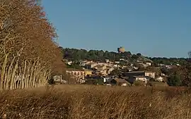 A general view of Campagnan | |
.svg.png.webp) Coat of arms | |
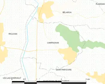
Location of Campagnan | |
 Campagnan  Campagnan | |
| Coordinates: 43°32′18″N 3°29′55″E / 43.5383°N 3.4986°E | |
| Country | France |
| Region | Occitania |
| Department | Hérault |
| Arrondissement | Lodève |
| Canton | Gignac |
| Intercommunality | Vallée de l'Hérault |
| Government | |
| • Mayor (2020–2026) | Jean-Marc Isure[1] |
| Area 1 | 3.75 km2 (1.45 sq mi) |
| Population | 724 |
| • Density | 190/km2 (500/sq mi) |
| Time zone | UTC+01:00 (CET) |
| • Summer (DST) | UTC+02:00 (CEST) |
| INSEE/Postal code | 34047 /34230 |
| Elevation | 18–123 m (59–404 ft) (avg. 32 m or 105 ft) |
| 1 French Land Register data, which excludes lakes, ponds, glaciers > 1 km2 (0.386 sq mi or 247 acres) and river estuaries. | |
Campagnan (French pronunciation: [kɑ̃paɲɑ̃]; Occitan: Campanhan) is a commune situated in the Hérault Department of Southern France.[3]
Map
Population
| Year | Pop. | ±% |
|---|---|---|
| 1962 | 332 | — |
| 1968 | 310 | −6.6% |
| 1975 | 303 | −2.3% |
| 1982 | 319 | +5.3% |
| 1990 | 329 | +3.1% |
| 1999 | 391 | +18.8% |
| 2008 | 536 | +37.1% |
See also
References
- ↑ "Répertoire national des élus: les maires" (in French). data.gouv.fr, Plateforme ouverte des données publiques françaises. 13 September 2022.
- ↑ "Populations légales 2021". The National Institute of Statistics and Economic Studies. 28 December 2023.
- ↑ Commune de Campagnan (34047), INSEE
Wikimedia Commons has media related to Campagnan.
This article is issued from Wikipedia. The text is licensed under Creative Commons - Attribution - Sharealike. Additional terms may apply for the media files.