Camplong-d'Aude | |
|---|---|
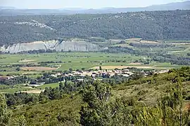 A general view of Camplong-d'Aude | |
.svg.png.webp) Coat of arms | |
Location of Camplong-d'Aude | |
 Camplong-d'Aude  Camplong-d'Aude | |
| Coordinates: 43°07′45″N 2°39′10″E / 43.1292°N 2.6528°E | |
| Country | France |
| Region | Occitania |
| Department | Aude |
| Arrondissement | Narbonne |
| Canton | Les Corbières |
| Intercommunality | Région Lézignanaise, Corbières et Minervois |
| Government | |
| • Mayor (2020–2026) | Serge Lépine[1] |
| Area 1 | 12.28 km2 (4.74 sq mi) |
| Population | 380 |
| • Density | 31/km2 (80/sq mi) |
| Time zone | UTC+01:00 (CET) |
| • Summer (DST) | UTC+02:00 (CEST) |
| INSEE/Postal code | 11064 /11200 |
| Elevation | 67–589 m (220–1,932 ft) (avg. 120 m or 390 ft) |
| 1 French Land Register data, which excludes lakes, ponds, glaciers > 1 km2 (0.386 sq mi or 247 acres) and river estuaries. | |
Camplong-d'Aude (French pronunciation: [kɑ̃plɔ̃ dod] ⓘ; Occitan: Camplong d'Aude) is a commune in the Aude department in southern France.
Population
| Year | Pop. | ±% |
|---|---|---|
| 1962 | 268 | — |
| 1968 | 288 | +7.5% |
| 1975 | 288 | +0.0% |
| 1982 | 236 | −18.1% |
| 1990 | 250 | +5.9% |
| 1999 | 270 | +8.0% |
| 2008 | 284 | +5.2% |
Geography
The river Orbieu forms most of the commune's southern border.
See also
References
- ↑ "Répertoire national des élus: les maires". data.gouv.fr, Plateforme ouverte des données publiques françaises (in French). 2 December 2020.
- ↑ "Populations légales 2021". The National Institute of Statistics and Economic Studies. 28 December 2023.
Wikimedia Commons has media related to Camplong-d'Aude.
This article is issued from Wikipedia. The text is licensed under Creative Commons - Attribution - Sharealike. Additional terms may apply for the media files.