Saint-Sernin | |
|---|---|
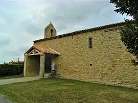 The church in Saint-Sernin | |
 Coat of arms | |
Location of Saint-Sernin | |
 Saint-Sernin  Saint-Sernin | |
| Coordinates: 43°14′N 1°48′E / 43.23°N 1.80°E | |
| Country | France |
| Region | Occitania |
| Department | Aude |
| Arrondissement | Carcassonne |
| Canton | La Piège au Razès |
| Government | |
| • Mayor (2020–2026) | Emilien Guilhemat[1] |
| Area 1 | 6.53 km2 (2.52 sq mi) |
| Population | 42 |
| • Density | 6.4/km2 (17/sq mi) |
| Time zone | UTC+01:00 (CET) |
| • Summer (DST) | UTC+02:00 (CEST) |
| INSEE/Postal code | 11365 /11420 |
| Elevation | 271–352 m (889–1,155 ft) (avg. 340 m or 1,120 ft) |
| 1 French Land Register data, which excludes lakes, ponds, glaciers > 1 km2 (0.386 sq mi or 247 acres) and river estuaries. | |
Saint-Sernin (French pronunciation: [sɛ̃ sɛʁnɛ̃] ⓘ; Occitan: Sant Sernin) is a commune in the Aude department in southern France.
Population
| Year | Pop. | ±% |
|---|---|---|
| 1962 | 9 | — |
| 1968 | 31 | +244.4% |
| 1975 | 43 | +38.7% |
| 1982 | 29 | −32.6% |
| 1990 | 35 | +20.7% |
| 1999 | 40 | +14.3% |
| 2008 | 33 | −17.5% |
See also
References
- ↑ "Répertoire national des élus: les maires". data.gouv.fr, Plateforme ouverte des données publiques françaises (in French). 9 August 2021.
- ↑ "Populations légales 2021". The National Institute of Statistics and Economic Studies. 28 December 2023.
Wikimedia Commons has media related to Saint-Sernin, Aude.
This article is issued from Wikipedia. The text is licensed under Creative Commons - Attribution - Sharealike. Additional terms may apply for the media files.