Saint-Martin-des-Puits | |
|---|---|
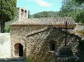 The church in Saint-Martin-des-Puits | |
.svg.png.webp) Coat of arms | |
Location of Saint-Martin-des-Puits | |
 Saint-Martin-des-Puits  Saint-Martin-des-Puits | |
| Coordinates: 43°02′29″N 2°34′10″E / 43.0414°N 2.5694°E | |
| Country | France |
| Region | Occitania |
| Department | Aude |
| Arrondissement | Narbonne |
| Canton | Les Corbières |
| Intercommunality | Région Lézignanaise, Corbières et Minervois |
| Government | |
| • Mayor (2020–2026) | Henri Riviere[1] |
| Area 1 | 6.94 km2 (2.68 sq mi) |
| Population | 29 |
| • Density | 4.2/km2 (11/sq mi) |
| Time zone | UTC+01:00 (CET) |
| • Summer (DST) | UTC+02:00 (CEST) |
| INSEE/Postal code | 11354 /11220 |
| Elevation | 170–470 m (560–1,540 ft) (avg. 210 m or 690 ft) |
| 1 French Land Register data, which excludes lakes, ponds, glaciers > 1 km2 (0.386 sq mi or 247 acres) and river estuaries. | |
Saint-Martin-des-Puits (French pronunciation: [sɛ̃ maʁtɛ̃ de pɥi] ⓘ; Languedocien: Sant Martin dels Poses) is a commune in the Aude department in southern France.
Population
| Year | Pop. | ±% |
|---|---|---|
| 1962 | 7 | — |
| 1968 | 147 | +2000.0% |
| 1975 | 127 | −13.6% |
| 1982 | 10 | −92.1% |
| 1990 | 21 | +110.0% |
| 1999 | 13 | −38.1% |
| 2008 | 18 | +38.5% |
Geography
The commune is located in the Corbières Massif.
The village lies on the right bank of the Orbieu, which flows northeast through the Commune.
See also
References
- ↑ "Répertoire national des élus: les maires". data.gouv.fr, Plateforme ouverte des données publiques françaises (in French). 2 December 2020.
- ↑ "Populations légales 2021". The National Institute of Statistics and Economic Studies. 28 December 2023.
Wikimedia Commons has media related to Saint-Martin-des-Puits.
This article is issued from Wikipedia. The text is licensed under Creative Commons - Attribution - Sharealike. Additional terms may apply for the media files.