 | ||||
|---|---|---|---|---|
| Route information | ||||
| Auxiliary route of NH 60 | ||||
| Part of | ||||
| Length | 680 km (420 mi) | |||
| Major junctions | ||||
| North end | Thane | |||
| South end | Sankeshwar | |||
| Location | ||||
| Country | India | |||
| States | Maharashtra, Karnataka | |||
| Highway system | ||||
| ||||
National Highway 160, commonly referred to as NH 160 is a national highway in India.[1] It is a spur road of National Highway 60.[2] NH-160 traverses the states of Maharashtra and Karnataka in India.[3]
Route
- Maharashtra
Thane - Nashik - Sinnar - Shirdi - Ahmednagar - Daund - Kurkumbh - Baramati - Phaltan - Dahiwadi - Mayani - Vita - Tasgaon - Miraj - Karnataka border.[3][4]
- Karnataka
Maharashtra border -Kagwad- Chikodi - Sankeshwar.[3][4]
Junctions
 NH 48 Terminal Near Thane.
 NH 60 Terminal Near Sinnar.
 NH 160D near Kolhar.
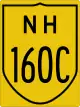 NH 160C near Rahuri.
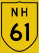 NH 61 near Ahmadnagar.
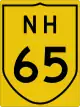 NH 65 near Kurkumbh.
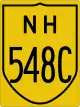 NH 548C near Dahiwadi.
 SH 143 near Mayani.
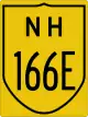 NH 166E near Vita.
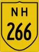 NH 266 near Tasgaon.
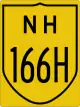 NH 166H near Miraj - Sangli.
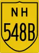 NH 548B near Kagwad.
- NH 48 Terminal near Sankeshwar - Gotur.
See also
References
- ↑ "Rationalisation of Numbering Systems of National Highways" (PDF). New Delhi: Department of Road Transport and Highways. Archived from the original (PDF) on 1 February 2016. Retrieved 3 April 2012.
- ↑ "New Numbering of National Highways notification - Government of India" (PDF). The Gazette of India. Retrieved 8 October 2018.
- 1 2 3 4 "State-wise length of National Highways (NH) in India as on 30.06.2017". Ministry of Road Transport and Highways. Retrieved 8 October 2018.
- 1 2 3 "New highways notification dated January, 2017 - New route for NH-160" (PDF). The Gazette of India - Ministry of Road Transport and Highways. Retrieved 8 October 2018.
External links


Secondary routes of National Highway 60 | ||
|---|---|---|
| ||
| Secondary Routes of NH 60 | ||
This article is issued from Wikipedia. The text is licensed under Creative Commons - Attribution - Sharealike. Additional terms may apply for the media files.