 | ||||
|---|---|---|---|---|
 Durgapur Expressway - NH 19 | ||||
| Route information | ||||
| Part of | ||||
| Length | 1,323 km (822 mi) | |||
| Major junctions | ||||
| West end | Agra | |||
| East end | Dankuni, Kolkata | |||
| Location | ||||
| Country | India | |||
| States | Uttar Pradesh, Bihar, Jharkhand, West Bengal | |||
| Primary destinations | Etawah, Kanpur, Fatehpur, Prayagraj, Varanasi, Mughalsarai, Sasaram, Aurangabad, Dhanbad, Asansol, Durgapur | |||
| Highway system | ||||
| ||||
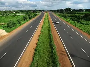
National Highway 19 (NH 19) is a national highway in India.[1] It was previously referred to as Delhi–Kolkata Road and is one of the busiest national highways in India. After renumbering of national highways, Delhi to Agra route is now national highway 44 and Agra to Kolkata route is numbered national highway 19.[2][3] It constitutes a major portion of the historical Grand Trunk Road. It is also part of AH1 of Asian Highway Network, that traverses from Japan to Turkey.
It was earlier known as NH 2 (Old) before renumbering of all national highways by Ministry of Road Transport and Highways in 2010.
Length
The highway has a length of 1,269.7 km (789.0 mi) and runs through the states of Uttar Pradesh, Bihar, Jharkhand, and West Bengal.[4][2]
The lengths of the highway in each state are:
- Uttar Pradesh: 655.2 km (407.1 mi)
- Bihar: 206 km (128 mi)
- Jharkhand: 199.8 km (124.1 mi)
- West Bengal: 208.7 km (129.7 mi)
National Highways Development Project
.jpg.webp)
- Almost all of the 1,269.7 km (789.0 mi) stretch of NH 19 has been selected as a part of the Golden Quadrilateral by the National Highways Development Project.[5]
- Approximately 35 km (22 mi) stretch of NH 19 between Barah and Kanpur has been selected as a part of the East-West Corridor by the National Highways Development Project.[5]
Route

National Highway 19 connects Agra to Kolkata and transits four states of India, namely Uttar Pradesh, Bihar, Jharkhand and west Bengal.[2][4]
NH 19 starts at Agra from its junction with NH-44 connecting Kanpur, Allahabad, Varanasi in the State of Uttar Pradesh, Mohania, Sasaram, Dehri On Sone, Aurangabad in the State of Bihar, Barhi, Bagodar, Gobindpur in the State of Jharkhand, Asansol, Palsit and terminating at its junction with NH-16 near Kolkata in the State of West Bengal.
Toll plazas
From Agra to Kolkata the toll plazas are as follows:
- Uttar Pradesh
- Tundla, Gurau Semra Atikabad, Anantram, Barajod, Badauri, Katoghan, Prayagraj Bypass (Khokhraj), Lalanagar, Daffi,Varanasi
- Bihar
- Mohania, Sasaram, Saukala
- Jharkhand
- Rasoiya Dhamna, Ghangri, Beliyad
- West Bengal
- Durgapur, Palsit and Dankuni.[6]
Major cities on/off NH 19
- Uttar Pradesh
- Mathura
- Agra
- Firozabad
- Etawah
- Babarpur Ajitmal
- Auraiya
- Akbarpur
- Kanpur
- Fatehpur
- Prayagraj
- Bhadohi
- Mirzapur
- Varanasi
- Mughalsarai
- Bihar
- Jharkhand
- West Bengal
Junctions
- Uttar Pradesh
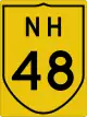 NH 48 Terminal near Agra.[2]
- Interchange with Agra Lucknow Expressway near village Kathphori
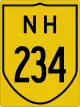 NH 234 near Etawah
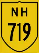 NH 719 near Etawah
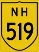 NH 519 near Sikandara
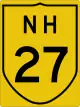 NH 27 near Akbarpur, Kanpur Dehat
 NH 34 near Kanpur
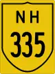 NH 335 near Fatehpur
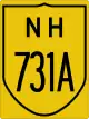 NH 731A near Muratganj
 NH 30 near Allahabad
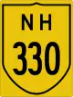 NH 330 near Soraon
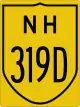 NH 319D near Prayagraj
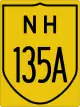 NH 135A near Aura
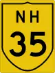 NH 35 near Varanasi
 NH 219 near Chandauli
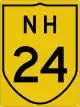 NH 24 near Saiyad Raja
- Bihar
- NH 219 near Mohania
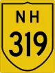 NH 319 near Mohania
 NH 119 near Dehri
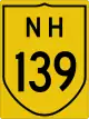 NH 139 near Aurangabad
 NH 22 near Dobhi
- Jharkhand
 NH 20 near Barhi
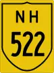 NH 522 near Bagodar
 NH 114A near Dumri
 NH 18 near Gobindpur
 NH 419 near Gobindpur
See also
References
- ↑ "Rationalisation of Numbering Systems of National Highways" (PDF). New Delhi: Department of Road Transport and Highways. Archived from the original (PDF) on 1 February 2016. Retrieved 3 April 2012.
- 1 2 3 4 5 "Route substitution (amendment) for national highways 9, 19, 44 and 48 dated February 2017" (PDF). The Gazette of India. Retrieved 6 December 2018.
- ↑ "New Numbering of National Highways notification - Government of India" (PDF). The Gazette of India. Retrieved 18 April 2019.
- 1 2 "State-wise length of National Highways (NH) in India". Ministry of Road Transport and Highways. Retrieved 18 April 2019.
- 1 2 Archived 25 February 2009 at the Wayback Machine National Highways-Source-National Highways Authority of India (NHAI)
- ↑ "Toll Calculator". Toll between. Retrieved 25 January 2017.
External links


Secondary routes of National Highway 19 | ||
|---|---|---|
| ||
| Secondary Routes of NH 19 | ||
| Across the whole continent | 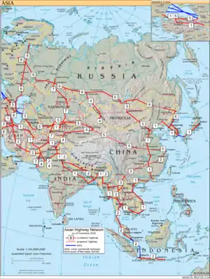 | |
|---|---|---|
| Southeast Asia | ||
| East Asia, Northeast Asia and Southeast Asia | ||
| South Asia | ||
| North Asia, Central Asia and Southwest Asia | ||