 | ||||
|---|---|---|---|---|
| Route information | ||||
| Length | 552 km (343 mi) | |||
| Major junctions | ||||
| From | Dwarka, Gujarat | |||
| To | Kuda, Gujarat | |||
| Location | ||||
| Country | India | |||
| States | Gujarat | |||
| Primary destinations | Dwarka - Bhogat - Porbandar - Mangrol - Veraval Somnath - Kodinar - Una - Rajula - Mahuva - Bhavnagar | |||
| Highway system | ||||
| ||||
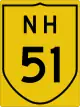
National Highway 51 (NH 51) is an Indian National Highway entirely within the state of Gujarat. NH 8E links Dwarka with Bhavnagar and is 551 km (342 mi) long. [1]
Route
Bet Dwarka including Signatur Somnath Rajula, Mahuva, Talaja, Bhavnagar.[2]
See also
References
- ↑ Archived 25 February 2009 at the Wayback Machine National Highways Authority of India (NHAI)
- ↑ "New NHs and route substitutions notification dated 5th September, 2014" (PDF). The Gazette of India - Ministry of Road Transport and Highways. Retrieved 23 July 2018.
External links


Secondary routes of National Highway 51 | ||
|---|---|---|
| Route in States of India | | |
| Secondary Routes of NH 51 | ||
This article is issued from Wikipedia. The text is licensed under Creative Commons - Attribution - Sharealike. Additional terms may apply for the media files.