Ogy-Montoy-Flanville | |
|---|---|
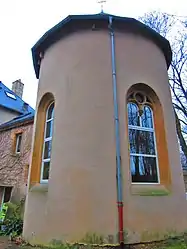 The chapel in Montoy | |
|
Coat of arms | |
Location of Ogy-Montoy-Flanville | |
 Ogy-Montoy-Flanville  Ogy-Montoy-Flanville | |
| Coordinates: 49°07′19″N 6°16′55″E / 49.122°N 6.282°E | |
| Country | France |
| Region | Grand Est |
| Department | Moselle |
| Arrondissement | Metz |
| Canton | Le Pays Messin |
| Intercommunality | Haut Chemin-Pays de Pange |
| Government | |
| • Mayor (2020–2026) | Éric Gulino[1] |
| Area 1 | 10.06 km2 (3.88 sq mi) |
| Population | 1,762 |
| • Density | 180/km2 (450/sq mi) |
| Time zone | UTC+01:00 (CET) |
| • Summer (DST) | UTC+02:00 (CEST) |
| INSEE/Postal code | 57482 /57530, 57645 |
| 1 French Land Register data, which excludes lakes, ponds, glaciers > 1 km2 (0.386 sq mi or 247 acres) and river estuaries. | |
Ogy-Montoy-Flanville (French pronunciation: [ɔʒi mɔ̃twa flɑ̃vil]; German: Ogingen-Montingen-Flanheim) is a commune in the department of Moselle, northeastern France. The municipality was established on 1 January 2017 by merger of the former communes of Montoy-Flanville (the seat) and Ogy.[3]
See also
References
- ↑ "Répertoire national des élus: les maires" (in French). data.gouv.fr, Plateforme ouverte des données publiques françaises. 13 September 2022.
- ↑ "Populations légales 2021". The National Institute of Statistics and Economic Studies. 28 December 2023.
- ↑ Arrêté préfectoral 22 December 2016 (in French)
External links
 Media related to Ogy-Montoy-Flanville at Wikimedia Commons
This article is issued from Wikipedia. The text is licensed under Creative Commons - Attribution - Sharealike. Additional terms may apply for the media files.