Villers-sur-Nied | |
|---|---|
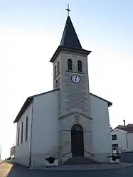 The church in Villers-sur-Nied | |
 Coat of arms | |
Location of Villers-sur-Nied | |
 Villers-sur-Nied  Villers-sur-Nied | |
| Coordinates: 48°55′21″N 6°32′12″E / 48.9225°N 6.5367°E | |
| Country | France |
| Region | Grand Est |
| Department | Moselle |
| Arrondissement | Sarrebourg-Château-Salins |
| Canton | Le Saulnois |
| Intercommunality | CC du Saulnois |
| Government | |
| • Mayor (2020–2026) | Jean-François Lemale[1] |
| Area 1 | 4.25 km2 (1.64 sq mi) |
| Population | 82 |
| • Density | 19/km2 (50/sq mi) |
| Time zone | UTC+01:00 (CET) |
| • Summer (DST) | UTC+02:00 (CEST) |
| INSEE/Postal code | 57719 /57340 |
| Elevation | 244–358 m (801–1,175 ft) (avg. 250 m or 820 ft) |
| 1 French Land Register data, which excludes lakes, ponds, glaciers > 1 km2 (0.386 sq mi or 247 acres) and river estuaries. | |
Villers-sur-Nied (German: Niedweiler) is a commune in the Moselle department in Grand Est in north-eastern France.
See also
References
- ↑ "Répertoire national des élus: les maires". data.gouv.fr, Plateforme ouverte des données publiques françaises (in French). 2 December 2020.
- ↑ "Populations légales 2021". The National Institute of Statistics and Economic Studies. 28 December 2023.
External links
 Media related to Villers-sur-Nied at Wikimedia Commons
This article is issued from Wikipedia. The text is licensed under Creative Commons - Attribution - Sharealike. Additional terms may apply for the media files.