Saint-Epvre | |
|---|---|
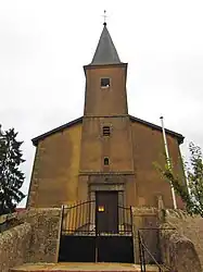 The church in Saint-Epvre | |
 Coat of arms | |
Location of Saint-Epvre | |
 Saint-Epvre  Saint-Epvre | |
| Coordinates: 48°58′29″N 6°26′17″E / 48.9747°N 6.4381°E | |
| Country | France |
| Region | Grand Est |
| Department | Moselle |
| Arrondissement | Sarrebourg-Château-Salins |
| Canton | Le Saulnois |
| Intercommunality | CC Saulnois |
| Government | |
| • Mayor (2020–2026) | Jean-Pierre Leonard[1] |
| Area 1 | 4.67 km2 (1.80 sq mi) |
| Population | 174 |
| • Density | 37/km2 (97/sq mi) |
| Time zone | UTC+01:00 (CET) |
| • Summer (DST) | UTC+02:00 (CEST) |
| INSEE/Postal code | 57609 /57580 |
| Elevation | 224–267 m (735–876 ft) (avg. 215 m or 705 ft) |
| 1 French Land Register data, which excludes lakes, ponds, glaciers > 1 km2 (0.386 sq mi or 247 acres) and river estuaries. | |
Saint-Epvre (French pronunciation: [sɛ̃t‿ɛvʁ]; German: Sankt Erffert) is a commune in the Moselle department, Grand Est, northeastern France.[3]
See also
References
- ↑ "Répertoire national des élus: les maires". data.gouv.fr, Plateforme ouverte des données publiques françaises (in French). 2 December 2020.
- ↑ "Populations légales 2021". The National Institute of Statistics and Economic Studies. 28 December 2023.
- ↑ INSEE commune file
External links
 Media related to Saint-Epvre at Wikimedia Commons
This article is issued from Wikipedia. The text is licensed under Creative Commons - Attribution - Sharealike. Additional terms may apply for the media files.