Sanry-sur-Nied | |
|---|---|
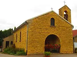 The chapel in Sanry-sur-Nied | |
.svg.png.webp) Coat of arms | |
Location of Sanry-sur-Nied | |
 Sanry-sur-Nied  Sanry-sur-Nied | |
| Coordinates: 49°03′12″N 6°20′41″E / 49.0533°N 6.3447°E | |
| Country | France |
| Region | Grand Est |
| Department | Moselle |
| Arrondissement | Metz |
| Canton | Le Pays Messin |
| Intercommunality | Haut Chemin - Pays de Pange |
| Government | |
| • Mayor (2020–2026) | Marie-Laure Poinsignon[1] |
| Area 1 | 4.81 km2 (1.86 sq mi) |
| Population | 389 |
| • Density | 81/km2 (210/sq mi) |
| Time zone | UTC+01:00 (CET) |
| • Summer (DST) | UTC+02:00 (CEST) |
| INSEE/Postal code | 57627 /57530 |
| Elevation | 215–300 m (705–984 ft) (avg. 220 m or 720 ft) |
| 1 French Land Register data, which excludes lakes, ponds, glaciers > 1 km2 (0.386 sq mi or 247 acres) and river estuaries. | |
Sanry-sur-Nied (French pronunciation: [sɑ̃ʁi syʁ nje], literally Sanry on Nied; German: Sanringen an der Nied) is a commune in the Moselle department in Grand Est in north-eastern France.
See also
References
- ↑ "Répertoire national des élus: les maires". data.gouv.fr, Plateforme ouverte des données publiques françaises (in French). 2 December 2020.
- ↑ "Populations légales 2021". The National Institute of Statistics and Economic Studies. 28 December 2023.
External links
 Media related to Sanry-sur-Nied at Wikimedia Commons
This article is issued from Wikipedia. The text is licensed under Creative Commons - Attribution - Sharealike. Additional terms may apply for the media files.