Saint-Hilaire | |
|---|---|
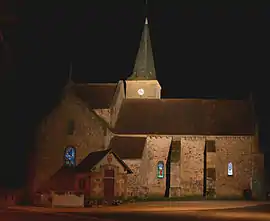 The church in Saint-Hilaire | |
 Coat of arms | |
Location of Saint-Hilaire | |
 Saint-Hilaire  Saint-Hilaire | |
| Coordinates: 46°29′43″N 3°01′15″E / 46.4953°N 3.0208°E | |
| Country | France |
| Region | Auvergne-Rhône-Alpes |
| Department | Allier |
| Arrondissement | Moulins |
| Canton | Bourbon-l'Archambault |
| Intercommunality | Bocage Bourbonnais |
| Government | |
| • Mayor (2020–2026) | Olivier Guiot[1] |
| Area 1 | 20.64 km2 (7.97 sq mi) |
| Population | 515 |
| • Density | 25/km2 (65/sq mi) |
| Time zone | UTC+01:00 (CET) |
| • Summer (DST) | UTC+02:00 (CEST) |
| INSEE/Postal code | 03238 /03440 |
| Elevation | 265–420 m (869–1,378 ft) (avg. 320 m or 1,050 ft) |
| 1 French Land Register data, which excludes lakes, ponds, glaciers > 1 km2 (0.386 sq mi or 247 acres) and river estuaries. | |
Saint-Hilaire (French pronunciation: [sɛ̃.t‿ilɛʁ] ⓘ) is a commune in the Allier department in Auvergne-Rhône-Alpes in central France.
Population
| Year | Pop. | ±% |
|---|---|---|
| 1962 | 796 | — |
| 1968 | 902 | +13.3% |
| 1975 | 700 | −22.4% |
| 1982 | 650 | −7.1% |
| 1990 | 595 | −8.5% |
| 1999 | 567 | −4.7% |
| 2008 | 524 | −7.6% |
| 2013 | 505 | −3.6% |
| Source: INSEE (1968–2013) | ||
See also
References
- ↑ "Répertoire national des élus: les maires". data.gouv.fr, Plateforme ouverte des données publiques françaises (in French). 2 December 2020.
- ↑ "Populations légales 2021". The National Institute of Statistics and Economic Studies. 28 December 2023.
Wikimedia Commons has media related to Saint-Hilaire (Allier).
This article is issued from Wikipedia. The text is licensed under Creative Commons - Attribution - Sharealike. Additional terms may apply for the media files.