Ars | |
|---|---|
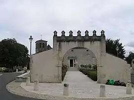 Town hall | |
Location of Ars | |
 Ars  Ars | |
| Coordinates: 45°38′38″N 0°22′52″W / 45.6439°N 0.3811°W | |
| Country | France |
| Region | Nouvelle-Aquitaine |
| Department | Charente |
| Arrondissement | Cognac |
| Canton | Cognac-2 |
| Intercommunality | CA Grand Cognac |
| Government | |
| • Mayor (2020–2026) | Dominique Simon André Burtin[1] |
| Area 1 | 11.40 km2 (4.40 sq mi) |
| Population | 699 |
| • Density | 61/km2 (160/sq mi) |
| Time zone | UTC+01:00 (CET) |
| • Summer (DST) | UTC+02:00 (CEST) |
| INSEE/Postal code | 16018 /16130 |
| Elevation | 5–58 m (16–190 ft) (avg. 20 m or 66 ft) |
| 1 French Land Register data, which excludes lakes, ponds, glaciers > 1 km2 (0.386 sq mi or 247 acres) and river estuaries. | |
Ars is a commune in the Charente department in southwestern France.
Population
| Year | Pop. | ±% p.a. |
|---|---|---|
| 1968 | 417 | — |
| 1975 | 482 | +2.09% |
| 1982 | 639 | +4.11% |
| 1990 | 750 | +2.02% |
| 1999 | 746 | −0.06% |
| 2009 | 716 | −0.41% |
| 2014 | 734 | +0.50% |
| 2020 | 704 | −0.69% |
| Source: INSEE[3] | ||
See also
References
- ↑ "Répertoire national des élus: les maires". data.gouv.fr, Plateforme ouverte des données publiques françaises (in French). 9 August 2021.
- ↑ "Populations légales 2021". The National Institute of Statistics and Economic Studies. 28 December 2023.
- ↑ Population en historique depuis 1968, INSEE
Wikimedia Commons has media related to Ars.
This article is issued from Wikipedia. The text is licensed under Creative Commons - Attribution - Sharealike. Additional terms may apply for the media files.