Saint-Georges | |
|---|---|
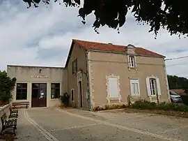 Town hall | |
Location of Saint-Georges | |
 Saint-Georges  Saint-Georges | |
| Coordinates: 45°58′24″N 0°16′18″E / 45.9733°N 0.2717°E | |
| Country | France |
| Region | Nouvelle-Aquitaine |
| Department | Charente |
| Arrondissement | Confolens |
| Canton | Charente-Nord |
| Government | |
| • Mayor (2020–2026) | Gilbert Ballon[1] |
| Area 1 | 2.25 km2 (0.87 sq mi) |
| Population | 45 |
| • Density | 20/km2 (52/sq mi) |
| Time zone | UTC+01:00 (CET) |
| • Summer (DST) | UTC+02:00 (CEST) |
| INSEE/Postal code | 16321 /16700 |
| Elevation | 76–125 m (249–410 ft) (avg. 122 m or 400 ft) |
| 1 French Land Register data, which excludes lakes, ponds, glaciers > 1 km2 (0.386 sq mi or 247 acres) and river estuaries. | |
Saint-Georges (French pronunciation: [sɛ̃ ʒɔʁʒ] ⓘ) is a commune in the Charente department in southwestern France.
Population
| Year | Pop. | ±% p.a. |
|---|---|---|
| 1968 | 76 | — |
| 1975 | 73 | −0.57% |
| 1982 | 71 | −0.40% |
| 1990 | 75 | +0.69% |
| 1999 | 67 | −1.25% |
| 2009 | 54 | −2.13% |
| 2014 | 56 | +0.73% |
| 2020 | 45 | −3.58% |
| Source: INSEE[3] | ||
See also
References
- ↑ "Répertoire national des élus: les maires". data.gouv.fr, Plateforme ouverte des données publiques françaises (in French). 2 December 2020.
- ↑ "Populations légales 2021". The National Institute of Statistics and Economic Studies. 28 December 2023.
- ↑ Population en historique depuis 1968, INSEE
Wikimedia Commons has media related to Saint-Georges (Charente).
This article is issued from Wikipedia. The text is licensed under Creative Commons - Attribution - Sharealike. Additional terms may apply for the media files.