Beaulieu | |
|---|---|
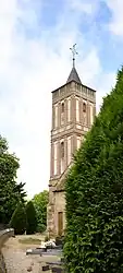 The church in Beaulieu | |
Location of Beaulieu | |
 Beaulieu  Beaulieu | |
| Coordinates: 48°40′52″N 0°44′41″E / 48.6811°N 0.7447°E | |
| Country | France |
| Region | Normandy |
| Department | Orne |
| Arrondissement | Mortagne-au-Perche |
| Canton | Tourouvre au Perche |
| Government | |
| • Mayor (2020–2026) | Emmanuel Le Secq[1] |
| Area 1 | 18.06 km2 (6.97 sq mi) |
| Population | 195 |
| • Density | 11/km2 (28/sq mi) |
| Time zone | UTC+01:00 (CET) |
| • Summer (DST) | UTC+02:00 (CEST) |
| INSEE/Postal code | 61034 /61190 |
| Elevation | 188–234 m (617–768 ft) (avg. 196 m or 643 ft) |
| 1 French Land Register data, which excludes lakes, ponds, glaciers > 1 km2 (0.386 sq mi or 247 acres) and river estuaries. | |
Beaulieu (French pronunciation: [boljø] ⓘ) is a commune in the Orne department in northwestern France.[3]
Population
| Year | Pop. | ±% p.a. |
|---|---|---|
| 1968 | 232 | — |
| 1975 | 213 | −1.21% |
| 1982 | 182 | −2.22% |
| 1990 | 186 | +0.27% |
| 1999 | 186 | +0.00% |
| 2009 | 215 | +1.46% |
| 2014 | 211 | −0.37% |
| 2020 | 199 | −0.97% |
| Source: INSEE[4] | ||
See also
References
- ↑ "Répertoire national des élus: les maires" (in French). data.gouv.fr, Plateforme ouverte des données publiques françaises. 13 September 2022.
- ↑ "Populations légales 2021". The National Institute of Statistics and Economic Studies. 28 December 2023.
- ↑ INSEE commune file
- ↑ Population en historique depuis 1968, INSEE
Wikimedia Commons has media related to Beaulieu (Orne).
This article is issued from Wikipedia. The text is licensed under Creative Commons - Attribution - Sharealike. Additional terms may apply for the media files.