Tanques | |
|---|---|
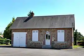 The town hall in Tanques | |
Location of Tanques | |
 Tanques  Tanques | |
| Coordinates: 48°41′17″N 0°04′19″W / 48.6881°N 0.0719°W | |
| Country | France |
| Region | Normandy |
| Department | Orne |
| Arrondissement | Argentan |
| Canton | Magny-le-Désert |
| Intercommunality | Argentan Intercom |
| Government | |
| • Mayor (2020–2026) | Lucienne Morin[1] |
| Area 1 | 6.22 km2 (2.40 sq mi) |
| Population | 157 |
| • Density | 25/km2 (65/sq mi) |
| Time zone | UTC+01:00 (CET) |
| • Summer (DST) | UTC+02:00 (CEST) |
| INSEE/Postal code | 61479 /61150 |
| Elevation | 153–234 m (502–768 ft) (avg. 163 m or 535 ft) |
| 1 French Land Register data, which excludes lakes, ponds, glaciers > 1 km2 (0.386 sq mi or 247 acres) and river estuaries. | |
Tanques (French pronunciation: [tɑ̃k] ⓘ) is a commune in the Orne department in north-western France.
Geography
The commune is made up of the following collection of villages and hamlets, Mengné,Les Coudraies and Tanques.[3]
It is 620 hectares (2.4 sq mi) in size. The highest point in the commune is 166 metres (545 ft).[4]
The River Cance, Marais de Fleuriel stream and the Bel Usse stream flow through the commune.[4]
Neighbouring communes[3] | ||||||||||||||||
|---|---|---|---|---|---|---|---|---|---|---|---|---|---|---|---|---|
| ||||||||||||||||
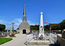
Saint-Pierre Church and War memorial
See also
References
- ↑ "Répertoire national des élus: les maires" (in French). data.gouv.fr, Plateforme ouverte des données publiques françaises. 13 September 2022.
- ↑ "Populations légales 2021". The National Institute of Statistics and Economic Studies. 28 December 2023.
- 1 2 "Tanques · France". Tanques · France.
- 1 2 "Mairie de Tanques et sa commune (61150)". Annuaire-Mairie. 4 September 2023.
Wikimedia Commons has media related to Tanques.
This article is issued from Wikipedia. The text is licensed under Creative Commons - Attribution - Sharealike. Additional terms may apply for the media files.