Saires-la-Verrerie | |
|---|---|
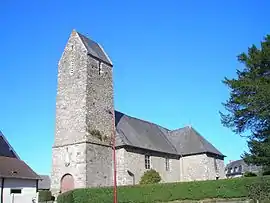 The church in Saires-la-Verrerie | |
Location of Saires-la-Verrerie | |
 Saires-la-Verrerie  Saires-la-Verrerie | |
| Coordinates: 48°41′14″N 0°29′42″W / 48.6872°N 0.495°W | |
| Country | France |
| Region | Normandy |
| Department | Orne |
| Arrondissement | Argentan |
| Canton | La Ferté-Macé |
| Intercommunality | CA Flers Agglo |
| Government | |
| • Mayor (2020–2026) | Charlie Letétrel[1] |
| Area 1 | 7.88 km2 (3.04 sq mi) |
| Population | 300 |
| • Density | 38/km2 (99/sq mi) |
| Time zone | UTC+01:00 (CET) |
| • Summer (DST) | UTC+02:00 (CEST) |
| INSEE/Postal code | 61459 /61220 |
| Elevation | 208–298 m (682–978 ft) (avg. 224 m or 735 ft) |
| 1 French Land Register data, which excludes lakes, ponds, glaciers > 1 km2 (0.386 sq mi or 247 acres) and river estuaries. | |
Saires-la-Verrerie (French pronunciation: [sɛʁ la vɛʁ.ʁi] ⓘ) is a commune in the Orne department in north-western France.
Geography
The commune is made up of the following collection of villages and hamlets, Varennes, Maison Oger and Saires-la-Verrerie.[3]
It is 790 hectares (3.1 sq mi) in size. The highest point in the commune is 235 metres (771 ft).[4]
Neighbouring communes[3] | ||||||||||||||||
|---|---|---|---|---|---|---|---|---|---|---|---|---|---|---|---|---|
| ||||||||||||||||
Twin towns – sister cities
Saires-la-Verrerie is twinned with:[5]
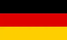 Wehretal, Germany
See also
References
- ↑ "Répertoire national des élus: les maires". data.gouv.fr, Plateforme ouverte des données publiques françaises (in French). 2 December 2020.
- ↑ "Populations légales 2021". The National Institute of Statistics and Economic Studies. 28 December 2023.
- 1 2 "Saires-la-Verrerie · 61220, France". Saires-la-Verrerie · 61220, France.
- ↑ "Mairie de Saires-la-Verrerie et sa commune (61220)". Annuaire-Mairie. 25 October 2023.
- ↑ "24 jumelages franco-allemands dans l'Orne". Ouest-France.fr. 21 January 2013.
Wikimedia Commons has media related to Saires-la-Verrerie.
This article is issued from Wikipedia. The text is licensed under Creative Commons - Attribution - Sharealike. Additional terms may apply for the media files.