Hauterive | |
|---|---|
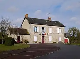 The town hall in Hauterive | |
.svg.png.webp) Coat of arms | |
Location of Hauterive | |
 Hauterive  Hauterive | |
| Coordinates: 48°28′42″N 0°12′02″E / 48.4783°N 0.2006°E | |
| Country | France |
| Region | Normandy |
| Department | Orne |
| Arrondissement | Alençon |
| Canton | Écouves |
| Intercommunality | Vallée de la Haute Sarthe |
| Government | |
| • Mayor (2020–2026) | Pierre Chatellier[1] |
| Area 1 | 6.98 km2 (2.69 sq mi) |
| Population | 462 |
| • Density | 66/km2 (170/sq mi) |
| Time zone | UTC+01:00 (CET) |
| • Summer (DST) | UTC+02:00 (CEST) |
| INSEE/Postal code | 61202 /61250 |
| Elevation | 132–160 m (433–525 ft) (avg. 145 m or 476 ft) |
| 1 French Land Register data, which excludes lakes, ponds, glaciers > 1 km2 (0.386 sq mi or 247 acres) and river estuaries. | |
Hauterive (French pronunciation: [otʁiv] ⓘ) is a commune in the Orne department in north-western France.
Notable buildings and places
- Château des Loges is a 17th century chateau that was listed as a Monument historique in 1995.[3]
See also
References
- ↑ "Répertoire national des élus: les maires". data.gouv.fr, Plateforme ouverte des données publiques françaises (in French). 9 August 2021.
- ↑ "Populations légales 2021". The National Institute of Statistics and Economic Studies. 28 December 2023.
- ↑ "Château des Loges à Hauterive - PA00135521". monumentum.fr.
Wikimedia Commons has media related to Hauterive (Orne).
This article is issued from Wikipedia. The text is licensed under Creative Commons - Attribution - Sharealike. Additional terms may apply for the media files.