Saint-Brice-sous-Rânes | |
|---|---|
 | |
Location of Saint-Brice-sous-Rânes | |
 Saint-Brice-sous-Rânes  Saint-Brice-sous-Rânes | |
| Coordinates: 48°40′47″N 0°11′29″W / 48.6797°N 0.1914°W | |
| Country | France |
| Region | Normandy |
| Department | Orne |
| Arrondissement | Argentan |
| Canton | Magny-le-Désert |
| Intercommunality | Argentan Intercom |
| Government | |
| • Mayor (2020–2026) | Katia Guillochin[1] |
| Area 1 | 9.45 km2 (3.65 sq mi) |
| Population | 134 |
| • Density | 14/km2 (37/sq mi) |
| Time zone | UTC+01:00 (CET) |
| • Summer (DST) | UTC+02:00 (CEST) |
| INSEE/Postal code | 61371 /61150 |
| Elevation | 164–249 m (538–817 ft) (avg. 216 m or 709 ft) |
| 1 French Land Register data, which excludes lakes, ponds, glaciers > 1 km2 (0.386 sq mi or 247 acres) and river estuaries. | |
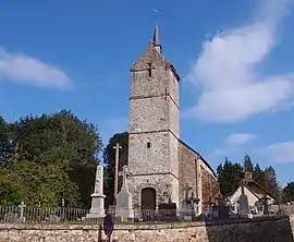
Saint-Brice-sous-Rânes (French pronunciation: [sɛ̃ bʁis su ʁan] ⓘ, literally Saint-Brice under Rânes) is a commune in the Orne department in north-western France.[3]
Geography
The commune is made up of the following collection of villages and hamlets, Les Hues,Le Bisson and Saint-Brice-sous-Rânes.[4]
There are 5 streams which flow through the commune, the Chalau, the Aunais, the Gosu, la Barbottiere and La Noeve.[5]
Neighbouring communes[4] | ||||||||||||||||
|---|---|---|---|---|---|---|---|---|---|---|---|---|---|---|---|---|
| ||||||||||||||||
See also
References
- ↑ "Répertoire national des élus: les maires". data.gouv.fr, Plateforme ouverte des données publiques françaises (in French). 2 December 2020.
- ↑ "Populations légales 2021". The National Institute of Statistics and Economic Studies. 28 December 2023.
- ↑ "Commune de Saint-Brice-sous-Rânes (61371) − COG | Insee". www.insee.fr.
- 1 2 "Saint-Brice-sous-Rânes · 61150, France". Saint-Brice-sous-Rânes · 61150, France.
- ↑ "Mairie de Saint-Brice-sous-Rânes et sa commune (61150)". Annuaire-Mairie. 5 September 2023.
Wikimedia Commons has media related to Saint-Brice-sous-Rânes.
This article is issued from Wikipedia. The text is licensed under Creative Commons - Attribution - Sharealike. Additional terms may apply for the media files.