Bullainville | |
|---|---|
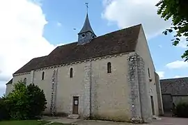 The church in Bullainville | |
Location of Bullainville | |
 Bullainville  Bullainville | |
| Coordinates: 48°10′18″N 1°30′33″E / 48.1716°N 1.5093°E | |
| Country | France |
| Region | Centre-Val de Loire |
| Department | Eure-et-Loir |
| Arrondissement | Châteaudun |
| Canton | Les Villages Vovéens |
| Intercommunality | CC Bonnevalais |
| Government | |
| • Mayor (2020–2026) | Jack Dazard[1] |
| Area 1 | 6.66 km2 (2.57 sq mi) |
| Population | 106 |
| • Density | 16/km2 (41/sq mi) |
| Time zone | UTC+01:00 (CET) |
| • Summer (DST) | UTC+02:00 (CEST) |
| INSEE/Postal code | 28065 /28800 |
| Elevation | 131–141 m (430–463 ft) (avg. 140 m or 460 ft) |
| 1 French Land Register data, which excludes lakes, ponds, glaciers > 1 km2 (0.386 sq mi or 247 acres) and river estuaries. | |
Bullainville (French pronunciation: [bylɛ̃vil]) is a commune in the Eure-et-Loir department and Centre-Val de Loire region of north-central France. It lies 30 km south of Chartres and some 100 km south-west of Paris.
Population
| Year | Pop. | ±% p.a. |
|---|---|---|
| 1968 | 133 | — |
| 1975 | 115 | −2.06% |
| 1982 | 101 | −1.84% |
| 1990 | 95 | −0.76% |
| 1999 | 83 | −1.49% |
| 2009 | 115 | +3.31% |
| 2014 | 108 | −1.25% |
| 2020 | 107 | −0.15% |
| Source: INSEE[3] | ||
See also
References
- ↑ "Répertoire national des élus: les maires". data.gouv.fr, Plateforme ouverte des données publiques françaises (in French). 2 December 2020.
- ↑ "Populations légales 2021". The National Institute of Statistics and Economic Studies. 28 December 2023.
- ↑ Population en historique depuis 1968, INSEE
Wikimedia Commons has media related to Bullainville.
This article is issued from Wikipedia. The text is licensed under Creative Commons - Attribution - Sharealike. Additional terms may apply for the media files.