Coudray-au-Perche | |
|---|---|
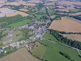 An aerial view of Coudray-au-Perche | |
.svg.png.webp) Coat of arms | |
Location of Coudray-au-Perche | |
 Coudray-au-Perche  Coudray-au-Perche | |
| Coordinates: 48°13′59″N 0°51′27″E / 48.2331°N 0.8575°E | |
| Country | France |
| Region | Centre-Val de Loire |
| Department | Eure-et-Loir |
| Arrondissement | Nogent-le-Rotrou |
| Canton | Brou |
| Intercommunality | Perche |
| Government | |
| • Mayor (2020–2026) | Nathalie Brunet[1] |
| Area 1 | 14.64 km2 (5.65 sq mi) |
| Population | 362 |
| • Density | 25/km2 (64/sq mi) |
| Time zone | UTC+01:00 (CET) |
| • Summer (DST) | UTC+02:00 (CEST) |
| INSEE/Postal code | 28111 /28330 |
| Elevation | 134–270 m (440–886 ft) (avg. 166 m or 545 ft) |
| 1 French Land Register data, which excludes lakes, ponds, glaciers > 1 km2 (0.386 sq mi or 247 acres) and river estuaries. | |
Coudray-au-Perche (French pronunciation: [kudʁɛ o pɛʁʃ]) is a commune in the Eure-et-Loir department in northern France.
Population
| Year | Pop. | ±% |
|---|---|---|
| 1962 | 302 | — |
| 1968 | 339 | +12.3% |
| 1975 | 283 | −16.5% |
| 1982 | 253 | −10.6% |
| 1990 | 276 | +9.1% |
| 1999 | 328 | +18.8% |
| 2008 | 373 | +13.7% |
See also
References
- ↑ "Répertoire national des élus: les maires". data.gouv.fr, Plateforme ouverte des données publiques françaises (in French). 9 August 2021.
- ↑ "Populations légales 2021". The National Institute of Statistics and Economic Studies. 28 December 2023.
Wikimedia Commons has media related to Coudray-au-Perche.
This article is issued from Wikipedia. The text is licensed under Creative Commons - Attribution - Sharealike. Additional terms may apply for the media files.