Varize | |
|---|---|
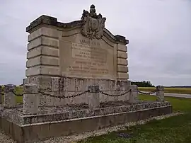 War memorial | |
Location of Varize | |
 Varize  Varize | |
| Coordinates: 48°05′44″N 1°30′52″E / 48.0956°N 1.5144°E | |
| Country | France |
| Region | Centre-Val de Loire |
| Department | Eure-et-Loir |
| Arrondissement | Châteaudun |
| Canton | Les Villages Vovéens |
| Government | |
| • Mayor (2020–2026) | Philippe Gaucheron[1] |
| Area 1 | 13.85 km2 (5.35 sq mi) |
| Population | 193 |
| • Density | 14/km2 (36/sq mi) |
| Time zone | UTC+01:00 (CET) |
| • Summer (DST) | UTC+02:00 (CEST) |
| INSEE/Postal code | 28400 /28140 |
| Elevation | 112–137 m (367–449 ft) (avg. 118 m or 387 ft) |
| 1 French Land Register data, which excludes lakes, ponds, glaciers > 1 km2 (0.386 sq mi or 247 acres) and river estuaries. | |
Varize (French pronunciation: [vaʁiz]) is a commune in the Eure-et-Loir department in northern France.
Population
| Year | Pop. | ±% |
|---|---|---|
| 1962 | 160 | — |
| 1968 | 222 | +38.7% |
| 1975 | 189 | −14.9% |
| 1982 | 176 | −6.9% |
| 1990 | 180 | +2.3% |
| 1999 | 167 | −7.2% |
| 2008 | 210 | +25.7% |
See also
References
- ↑ "Répertoire national des élus: les maires" (in French). data.gouv.fr, Plateforme ouverte des données publiques françaises. 4 May 2022.
- ↑ "Populations légales 2021". The National Institute of Statistics and Economic Studies. 28 December 2023.
Wikimedia Commons has media related to Varize (Eure-et-Loir).
This article is issued from Wikipedia. The text is licensed under Creative Commons - Attribution - Sharealike. Additional terms may apply for the media files.