Le Boullay-Thierry | |
|---|---|
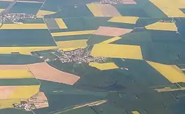 Aerial view (2018) | |
Location of Le Boullay-Thierry | |
 Le Boullay-Thierry  Le Boullay-Thierry | |
| Coordinates: 48°38′20″N 1°25′52″E / 48.6389°N 1.4311°E | |
| Country | France |
| Region | Centre-Val de Loire |
| Department | Eure-et-Loir |
| Arrondissement | Dreux |
| Canton | Dreux-2 |
| Intercommunality | CA Pays de Dreux |
| Government | |
| • Mayor (2020–2026) | Frédéric Giroux[1] |
| Area 1 | 12.87 km2 (4.97 sq mi) |
| Population | 570 |
| • Density | 44/km2 (110/sq mi) |
| Time zone | UTC+01:00 (CET) |
| • Summer (DST) | UTC+02:00 (CEST) |
| INSEE/Postal code | 28055 /28210 |
| Elevation | 110–176 m (361–577 ft) (avg. 150 m or 490 ft) |
| 1 French Land Register data, which excludes lakes, ponds, glaciers > 1 km2 (0.386 sq mi or 247 acres) and river estuaries. | |
Le Boullay-Thierry (French pronunciation: [lə bulɛ tjɛʁi]) is a commune in the Eure-et-Loir department in France.
Population
| Year | Pop. | ±% |
|---|---|---|
| 1962 | 228 | — |
| 1968 | 234 | +2.6% |
| 1975 | 282 | +20.5% |
| 1982 | 324 | +14.9% |
| 1990 | 348 | +7.4% |
| 1999 | 483 | +38.8% |
| 2008 | 542 | +12.2% |
See also
References
- ↑ "Répertoire national des élus: les maires". data.gouv.fr, Plateforme ouverte des données publiques françaises (in French). 2 December 2020.
- ↑ "Populations légales 2021". The National Institute of Statistics and Economic Studies. 28 December 2023.
Wikimedia Commons has media related to Le Boullay-Thierry.
This article is issued from Wikipedia. The text is licensed under Creative Commons - Attribution - Sharealike. Additional terms may apply for the media files.