Gohory | |
|---|---|
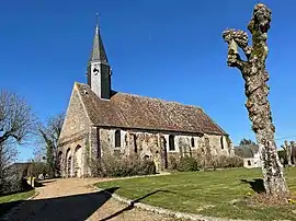 Saint-Michel church | |
Location of Gohory | |
 Gohory  Gohory | |
| Coordinates: 48°10′01″N 1°13′43″E / 48.1669°N 1.2287°E | |
| Country | France |
| Region | Centre-Val de Loire |
| Department | Eure-et-Loir |
| Arrondissement | Châteaudun |
| Canton | Brou |
| Intercommunality | CC du Grand Châteaudun |
| Government | |
| • Mayor (2020–2026) | François Malzert[1] |
| Area 1 | 9.47 km2 (3.66 sq mi) |
| Population | 316 |
| • Density | 33/km2 (86/sq mi) |
| Time zone | UTC+01:00 (CET) |
| • Summer (DST) | UTC+02:00 (CEST) |
| INSEE/Postal code | 28182 /28160 |
| Elevation | 161–180 m (528–591 ft) (avg. 170 m or 560 ft) |
| 1 French Land Register data, which excludes lakes, ponds, glaciers > 1 km2 (0.386 sq mi or 247 acres) and river estuaries. | |
Gohory (French pronunciation: [ɡɔ.ɔʁi]) is a commune in the Eure-et-Loir department and Centre-Val de Loire region of north-central France. It lies 36 km south-west of Chartres and some 115 km from Paris.
Population
| Year | Pop. | ±% p.a. |
|---|---|---|
| 1968 | 258 | — |
| 1975 | 226 | −1.87% |
| 1982 | 223 | −0.19% |
| 1990 | 234 | +0.60% |
| 1999 | 222 | −0.58% |
| 2009 | 301 | +3.09% |
| 2014 | 328 | +1.73% |
| 2020 | 316 | −0.62% |
| Source: INSEE[3] | ||
See also
References
- ↑ "Répertoire national des élus: les maires". data.gouv.fr, Plateforme ouverte des données publiques françaises (in French). 2 December 2020.
- ↑ "Populations légales 2021". The National Institute of Statistics and Economic Studies. 28 December 2023.
- ↑ Population en historique depuis 1968, INSEE
Wikimedia Commons has media related to Gohory.
This article is issued from Wikipedia. The text is licensed under Creative Commons - Attribution - Sharealike. Additional terms may apply for the media files.