Vald'Yerre | |
|---|---|
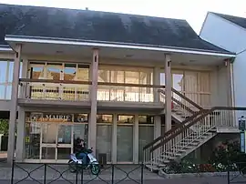 Vald'Yerre Town Hall | |
Location of Vald'Yerre | |
 Vald'Yerre  Vald'Yerre | |
| Coordinates: 48°06′04″N 1°07′26″E / 48.101°N 1.124°E | |
| Country | France |
| Region | Centre-Val de Loire |
| Department | Eure-et-Loir |
| Arrondissement | Châteaudun |
| Canton | Brou |
| Intercommunality | CC Grand Châteaudun |
| Government | |
| • Mayor (2020–2026) | Franck Marchand[1] |
| Area 1 | 145.30 km2 (56.10 sq mi) |
| Population | 3,577 |
| • Density | 25/km2 (64/sq mi) |
| Time zone | UTC+01:00 (CET) |
| • Summer (DST) | UTC+02:00 (CEST) |
| INSEE/Postal code | 28012 /28290 |
| 1 French Land Register data, which excludes lakes, ponds, glaciers > 1 km2 (0.386 sq mi or 247 acres) and river estuaries. | |
Vald'Yerre (French pronunciation: [valdjɛʁ]; before 2023: Commune nouvelle d'Arrou [kɔmyn nuvɛl daʁu], literally New Commune of Arrou) is a commune in the department of Eure-et-Loir, north-central France. The municipality was established on 1 January 2017 by merger of the former communes of Arrou (the seat), Boisgasson, Châtillon-en-Dunois, Courtalain, Langey and Saint-Pellerin.[3]
Population
| Year | Pop. | ±% p.a. |
|---|---|---|
| 1968 | 4,400 | — |
| 1975 | 3,989 | −1.39% |
| 1982 | 3,964 | −0.09% |
| 1990 | 3,820 | −0.46% |
| 1999 | 3,792 | −0.08% |
| 2007 | 3,864 | +0.24% |
| 2012 | 3,890 | +0.13% |
| 2017 | 3,803 | −0.45% |
| Source: INSEE[4] | ||
See also
References
Wikimedia Commons has media related to Vald'Yerre.
- ↑ "Répertoire national des élus: les maires" (in French). data.gouv.fr, Plateforme ouverte des données publiques françaises. 13 September 2022.
- ↑ "Populations légales 2021". The National Institute of Statistics and Economic Studies. 28 December 2023.
- ↑ Arrêté préfectoral 25 May 2016 (in French)
- ↑ Population en historique depuis 1968, INSEE
This article is issued from Wikipedia. The text is licensed under Creative Commons - Attribution - Sharealike. Additional terms may apply for the media files.