Conan | |
|---|---|
 | |
Location of Conan | |
 Conan  Conan | |
| Coordinates: 47°44′58″N 1°17′14″E / 47.7494°N 1.2872°E | |
| Country | France |
| Region | Centre-Val de Loire |
| Department | Loir-et-Cher |
| Arrondissement | Blois |
| Canton | La Beauce |
| Government | |
| • Mayor (2020–2026) | Olivier Théophile[1] |
| Area 1 | 15.3 km2 (5.9 sq mi) |
| Population | 164 |
| • Density | 11/km2 (28/sq mi) |
| Time zone | UTC+01:00 (CET) |
| • Summer (DST) | UTC+02:00 (CEST) |
| INSEE/Postal code | 41057 /41290 |
| Elevation | 97–126 m (318–413 ft) (avg. 121 m or 397 ft) |
| 1 French Land Register data, which excludes lakes, ponds, glaciers > 1 km2 (0.386 sq mi or 247 acres) and river estuaries. | |
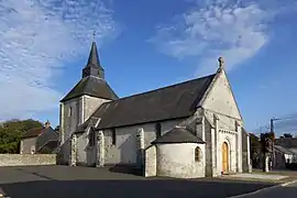
Conan (French pronunciation: [kɔnɑ̃]) is a commune in the Loir-et-Cher department of central France.[3]
Population
| Year | Pop. | ±% p.a. |
|---|---|---|
| 1968 | 229 | — |
| 1975 | 204 | −1.64% |
| 1982 | 170 | −2.57% |
| 1990 | 157 | −0.99% |
| 1999 | 189 | +2.08% |
| 2007 | 192 | +0.20% |
| 2012 | 206 | +1.42% |
| 2017 | 175 | −3.21% |
| Source: INSEE[4] | ||
See also
References
- ↑ "Répertoire national des élus: les maires". data.gouv.fr, Plateforme ouverte des données publiques françaises (in French). 2 December 2020.
- ↑ "Populations légales 2021". The National Institute of Statistics and Economic Studies. 28 December 2023.
- ↑ INSEE commune file
- ↑ Population en historique depuis 1968, INSEE
Wikimedia Commons has media related to Conan (Loir-et-Cher).
This article is issued from Wikipedia. The text is licensed under Creative Commons - Attribution - Sharealike. Additional terms may apply for the media files.