Villeny | |
|---|---|
Commune | |
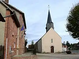 Town hall and church | |
Location of Villeny | |
 Villeny  Villeny | |
| Coordinates: 47°37′25″N 1°45′20″E / 47.6236°N 1.7556°E | |
| Country | France |
| Region | Centre-Val de Loire |
| Department | Loir-et-Cher |
| Arrondissement | Romorantin-Lanthenay |
| Canton | Chambord |
| Intercommunality | Sologne des étangs |
| Government | |
| • Mayor (2020–2026) | Hubert Chevallier[1] |
| Area 1 | 33.98 km2 (13.12 sq mi) |
| Population | 487 |
| • Density | 14/km2 (37/sq mi) |
| Time zone | UTC+01:00 (CET) |
| • Summer (DST) | UTC+02:00 (CEST) |
| INSEE/Postal code | 41285 /41220 |
| Elevation | 93–136 m (305–446 ft) (avg. 130 m or 430 ft) |
| 1 French Land Register data, which excludes lakes, ponds, glaciers > 1 km2 (0.386 sq mi or 247 acres) and river estuaries. | |
Villeny (French pronunciation: [vilni]) is a commune in the Loir-et-Cher department in central France.
Population
| Year | Pop. | ±% p.a. |
|---|---|---|
| 1968 | 461 | — |
| 1975 | 381 | −2.69% |
| 1982 | 336 | −1.78% |
| 1990 | 324 | −0.45% |
| 1999 | 334 | +0.34% |
| 2007 | 369 | +1.25% |
| 2012 | 432 | +3.20% |
| 2017 | 493 | +2.68% |
| Source: INSEE[3] | ||
See also
References
- ↑ "Répertoire national des élus: les maires". data.gouv.fr, Plateforme ouverte des données publiques françaises (in French). 9 August 2021.
- ↑ "Populations légales 2021". The National Institute of Statistics and Economic Studies. 28 December 2023.
- ↑ Population en historique depuis 1968, INSEE
Wikimedia Commons has media related to Villeny.
This article is issued from Wikipedia. The text is licensed under Creative Commons - Attribution - Sharealike. Additional terms may apply for the media files.