Soings-en-Sologne | |
|---|---|
Commune | |
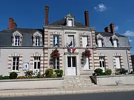 Town hall | |
.svg.png.webp) Coat of arms | |
Location of Soings-en-Sologne | |
 Soings-en-Sologne  Soings-en-Sologne | |
| Coordinates: 47°24′51″N 1°31′33″E / 47.4142°N 1.5258°E | |
| Country | France |
| Region | Centre-Val de Loire |
| Department | Loir-et-Cher |
| Arrondissement | Romorantin-Lanthenay |
| Canton | Saint-Aignan |
| Intercommunality | Val-de-Cher-Controis |
| Government | |
| • Mayor (2020–2026) | Bernard Biette[1] |
| Area 1 | 35.3 km2 (13.6 sq mi) |
| Population | 1,594 |
| • Density | 45/km2 (120/sq mi) |
| Time zone | UTC+01:00 (CET) |
| • Summer (DST) | UTC+02:00 (CEST) |
| INSEE/Postal code | 41247 /41230 |
| Elevation | 92–137 m (302–449 ft) (avg. 96 m or 315 ft) |
| 1 French Land Register data, which excludes lakes, ponds, glaciers > 1 km2 (0.386 sq mi or 247 acres) and river estuaries. | |
Soings-en-Sologne (French pronunciation: [swɛ̃ ɑ̃ sɔlɔɲ], lit. 'Soings in Sologne') is a commune and town in the French department of Loir-et-Cher, administrative region of Centre-Val de Loire.
Population
| Year | Pop. | ±% p.a. |
|---|---|---|
| 1968 | 1,324 | — |
| 1975 | 1,314 | −0.11% |
| 1982 | 1,259 | −0.61% |
| 1990 | 1,289 | +0.29% |
| 1999 | 1,314 | +0.21% |
| 2007 | 1,487 | +1.56% |
| 2012 | 1,583 | +1.26% |
| 2017 | 1,614 | +0.39% |
| Source: INSEE[3] | ||
See also
References
- ↑ "Répertoire national des élus: les maires" (in French). data.gouv.fr, Plateforme ouverte des données publiques françaises. 13 September 2022.
- ↑ "Populations légales 2021". The National Institute of Statistics and Economic Studies. 28 December 2023.
- ↑ Population en historique depuis 1968, INSEE
Wikimedia Commons has media related to Soings-en-Sologne.
This article is issued from Wikipedia. The text is licensed under Creative Commons - Attribution - Sharealike. Additional terms may apply for the media files.