Saint-Loup | |
|---|---|
Commune | |
 | |
Location of Saint-Loup | |
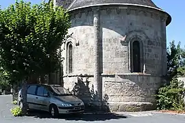
 Saint-Loup  Saint-Loup | |
| Coordinates: 47°15′58″N 1°50′25″E / 47.2661°N 1.8403°E | |
| Country | France |
| Region | Centre-Val de Loire |
| Department | Loir-et-Cher |
| Arrondissement | Romorantin-Lanthenay |
| Canton | Selles-sur-Cher |
| Government | |
| • Mayor (2020–2026) | Pierre Barbé[1] |
| Area 1 | 14.7 km2 (5.7 sq mi) |
| Population | 367 |
| • Density | 25/km2 (65/sq mi) |
| Time zone | UTC+01:00 (CET) |
| • Summer (DST) | UTC+02:00 (CEST) |
| INSEE/Postal code | 41222 /41320 |
| Elevation | 82–151 m (269–495 ft) (avg. 120 m or 390 ft) |
| 1 French Land Register data, which excludes lakes, ponds, glaciers > 1 km2 (0.386 sq mi or 247 acres) and river estuaries. | |
Saint-Loup (French pronunciation: [sɛ̃ lu]) is a commune in the Loir-et-Cher department in central France.[3]
Population
| Year | Pop. | ±% p.a. |
|---|---|---|
| 1968 | 230 | — |
| 1975 | 196 | −2.26% |
| 1982 | 231 | +2.37% |
| 1990 | 259 | +1.44% |
| 1999 | 298 | +1.57% |
| 2007 | 325 | +1.09% |
| 2012 | 369 | +2.57% |
| 2017 | 375 | +0.32% |
| Source: INSEE[4] | ||
See also
References
- ↑ "Répertoire national des élus: les maires". data.gouv.fr, Plateforme ouverte des données publiques françaises (in French). 2 December 2020.
- ↑ "Populations légales 2021". The National Institute of Statistics and Economic Studies. 28 December 2023.
- ↑ INSEE commune file
- ↑ Population en historique depuis 1968, INSEE
Wikimedia Commons has media related to Saint-Loup (Loir-et-Cher).
This article is issued from Wikipedia. The text is licensed under Creative Commons - Attribution - Sharealike. Additional terms may apply for the media files.