Grand-Charmont | |
|---|---|
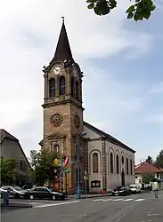 The Lutheran church in Grand-Charmont | |
 Coat of arms | |
Location of Grand-Charmont | |
 Grand-Charmont  Grand-Charmont | |
| Coordinates: 47°31′41″N 6°49′28″E / 47.5281°N 6.8244°E | |
| Country | France |
| Region | Bourgogne-Franche-Comté |
| Department | Doubs |
| Arrondissement | Montbéliard |
| Canton | Bethoncourt |
| Intercommunality | Pays de Montbéliard Agglomération |
| Government | |
| • Mayor (2020–2026) | Jean-Paul Munnier[1] |
| Area 1 | 4.56 km2 (1.76 sq mi) |
| Population | 5,857 |
| • Density | 1,300/km2 (3,300/sq mi) |
| Time zone | UTC+01:00 (CET) |
| • Summer (DST) | UTC+02:00 (CEST) |
| INSEE/Postal code | 25284 /25200 |
| Elevation | 324–425 m (1,063–1,394 ft) |
| 1 French Land Register data, which excludes lakes, ponds, glaciers > 1 km2 (0.386 sq mi or 247 acres) and river estuaries. | |
Grand-Charmont (French pronunciation: [ɡʁɑ̃ ʃaʁmɔ̃]) is a commune in the Doubs department in the Bourgogne-Franche-Comté region in eastern France.
Population
| Year | Pop. | ±% p.a. |
|---|---|---|
| 1968 | 7,201 | — |
| 1975 | 7,922 | +1.37% |
| 1982 | 7,139 | −1.48% |
| 1990 | 5,605 | −2.98% |
| 1999 | 5,104 | −1.03% |
| 2007 | 4,850 | −0.64% |
| 2012 | 5,319 | +1.86% |
| 2017 | 5,699 | +1.39% |
| Source: INSEE[3] | ||
See also
References
- ↑ "Répertoire national des élus: les maires" (in French). data.gouv.fr, Plateforme ouverte des données publiques françaises. 13 September 2022.
- ↑ "Populations légales 2021". The National Institute of Statistics and Economic Studies. 28 December 2023.
- ↑ Population en historique depuis 1968, INSEE
External links
Wikimedia Commons has media related to Grand-Charmont.
- Official website (in French)
This article is issued from Wikipedia. The text is licensed under Creative Commons - Attribution - Sharealike. Additional terms may apply for the media files.