Servin | |
|---|---|
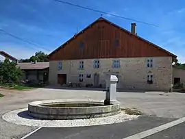 A farm in Servin | |
Location of Servin | |
 Servin  Servin | |
| Coordinates: 47°18′30″N 6°27′49″E / 47.3083°N 6.4636°E | |
| Country | France |
| Region | Bourgogne-Franche-Comté |
| Department | Doubs |
| Arrondissement | Besançon |
| Canton | Bavans |
| Government | |
| • Mayor (2021–2026) | Frédéric André[1] |
| Area 1 | 10.03 km2 (3.87 sq mi) |
| Population | 204 |
| • Density | 20/km2 (53/sq mi) |
| Time zone | UTC+01:00 (CET) |
| • Summer (DST) | UTC+02:00 (CEST) |
| INSEE/Postal code | 25544 /25430 |
| Elevation | 378–710 m (1,240–2,329 ft) |
| 1 French Land Register data, which excludes lakes, ponds, glaciers > 1 km2 (0.386 sq mi or 247 acres) and river estuaries. | |
Servin (French pronunciation: [sɛʁvɛ̃]) is a commune in the Doubs department in the Bourgogne-Franche-Comté region in eastern France.
Geography
Servin lies 18 km (11 mi) southeast of Baume-les-Dames on the Roman road from Besançon to the Rhine.
Population
| Year | Pop. | ±% |
|---|---|---|
| 1962 | 156 | — |
| 1968 | 148 | −5.1% |
| 1975 | 144 | −2.7% |
| 1982 | 149 | +3.5% |
| 1990 | 151 | +1.3% |
| 1999 | 164 | +8.6% |
| 2008 | 287 | +75.0% |
| 2012 | 188 | −34.5% |
See also
References
- ↑ "Répertoire national des élus: les maires". data.gouv.fr, Plateforme ouverte des données publiques françaises (in French). 9 August 2021.
- ↑ "Populations légales 2021". The National Institute of Statistics and Economic Studies. 28 December 2023.
External links
Wikimedia Commons has media related to Servin.
- Servin on the regional Web site (in French)
This article is issued from Wikipedia. The text is licensed under Creative Commons - Attribution - Sharealike. Additional terms may apply for the media files.