Tournans | |
|---|---|
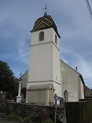 The church in Tournans | |
Location of Tournans | |
 Tournans  Tournans | |
| Coordinates: 47°24′51″N 6°19′41″E / 47.4142°N 6.3281°E | |
| Country | France |
| Region | Bourgogne-Franche-Comté |
| Department | Doubs |
| Arrondissement | Besançon |
| Canton | Baume-les-Dames |
| Government | |
| • Mayor (2020–2026) | Thierry Chierici[1] |
| Area 1 | 9.14 km2 (3.53 sq mi) |
| Population | 113 |
| • Density | 12/km2 (32/sq mi) |
| Time zone | UTC+01:00 (CET) |
| • Summer (DST) | UTC+02:00 (CEST) |
| INSEE/Postal code | 25567 /25680 |
| Elevation | 305–457 m (1,001–1,499 ft) |
| 1 French Land Register data, which excludes lakes, ponds, glaciers > 1 km2 (0.386 sq mi or 247 acres) and river estuaries. | |
Tournans (French pronunciation: [tuʁnɑ̃]) is a commune in the Doubs department in the Bourgogne-Franche-Comté region in eastern France.
Geography
Tournans lies 11 km (6.8 mi) south of Rougemont.
Population
| Year | Pop. | ±% |
|---|---|---|
| 1962 | 96 | — |
| 1968 | 112 | +16.7% |
| 1975 | 82 | −26.8% |
| 1982 | 83 | +1.2% |
| 1990 | 87 | +4.8% |
| 1999 | 119 | +36.8% |
| 2008 | 116 | −2.5% |
| 2012 | 125 | +7.8% |
See also
References
- ↑ "Répertoire national des élus: les maires". data.gouv.fr, Plateforme ouverte des données publiques françaises (in French). 9 August 2021.
- ↑ "Populations légales 2021". The National Institute of Statistics and Economic Studies. 28 December 2023.
External links
Wikimedia Commons has media related to Tournans.
- Tournans on the regional Web site (in French)
This article is issued from Wikipedia. The text is licensed under Creative Commons - Attribution - Sharealike. Additional terms may apply for the media files.