Neuchâtel-Urtière | |
|---|---|
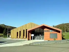 The town hall in Neuchâtel-Urtière | |
Location of Neuchâtel-Urtière | |
 Neuchâtel-Urtière  Neuchâtel-Urtière | |
| Coordinates: 47°23′N 6°44′E / 47.38°N 6.73°E | |
| Country | France |
| Region | Bourgogne-Franche-Comté |
| Department | Doubs |
| Arrondissement | Montbéliard |
| Canton | Valentigney |
| Intercommunality | Pays de Montbéliard Agglomération |
| Government | |
| • Mayor (2020–2026) | Gilles Bourdois[1] |
| Area 1 | 6.21 km2 (2.40 sq mi) |
| Population | 168 |
| • Density | 27/km2 (70/sq mi) |
| Time zone | UTC+01:00 (CET) |
| • Summer (DST) | UTC+02:00 (CEST) |
| INSEE/Postal code | 25422 /25150 |
| Elevation | 373–828 m (1,224–2,717 ft) |
| 1 French Land Register data, which excludes lakes, ponds, glaciers > 1 km2 (0.386 sq mi or 247 acres) and river estuaries. | |
Neuchâtel-Urtière (French pronunciation: [nøʃatl yʁtjɛʁ]) is a commune in the Doubs department in the Bourgogne-Franche-Comté region in eastern France.
Geography
The commune lies 15 km (9.3 mi) from Pont-de-Roide.
Population
| Year | Pop. | ±% |
|---|---|---|
| 1962 | 63 | — |
| 1968 | 73 | +15.9% |
| 1975 | 66 | −9.6% |
| 1982 | 83 | +25.8% |
| 1990 | 129 | +55.4% |
| 1999 | 149 | +15.5% |
| 2008 | 155 | +4.0% |
| 2012 | 167 | +7.7% |
See also
References
- ↑ "Répertoire national des élus: les maires". data.gouv.fr, Plateforme ouverte des données publiques françaises (in French). 9 August 2021.
- ↑ "Populations légales 2021". The National Institute of Statistics and Economic Studies. 28 December 2023.
External links
Wikimedia Commons has media related to Neuchâtel-Urtière.
This article is issued from Wikipedia. The text is licensed under Creative Commons - Attribution - Sharealike. Additional terms may apply for the media files.