Hérimoncourt | |
|---|---|
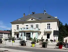 The town hall in Hérimoncourt | |
.svg.png.webp) Coat of arms | |
Location of Hérimoncourt | |
 Hérimoncourt  Hérimoncourt | |
| Coordinates: 47°26′29″N 6°53′02″E / 47.4414°N 6.8839°E | |
| Country | France |
| Region | Bourgogne-Franche-Comté |
| Department | Doubs |
| Arrondissement | Montbéliard |
| Canton | Audincourt |
| Intercommunality | Pays de Montbéliard Agglomération |
| Government | |
| • Mayor (2020–2026) | Marie-France Bottarlini-Caputo[1] |
| Area 1 | 7.29 km2 (2.81 sq mi) |
| Population | 3,575 |
| • Density | 490/km2 (1,300/sq mi) |
| Time zone | UTC+01:00 (CET) |
| • Summer (DST) | UTC+02:00 (CEST) |
| INSEE/Postal code | 25304 /25310 |
| Elevation | 350–578 m (1,148–1,896 ft) |
| 1 French Land Register data, which excludes lakes, ponds, glaciers > 1 km2 (0.386 sq mi or 247 acres) and river estuaries. | |
Hérimoncourt (French pronunciation: [eʁimɔ̃kuʁ]) is a commune in the Doubs department in the Bourgogne-Franche-Comté region in eastern France.
Population
| Year | Pop. | ±% p.a. |
|---|---|---|
| 1968 | 3,467 | — |
| 1975 | 3,180 | −1.23% |
| 1982 | 3,508 | +1.41% |
| 1990 | 3,923 | +1.41% |
| 1999 | 3,908 | −0.04% |
| 2007 | 3,863 | −0.14% |
| 2012 | 3,659 | −1.08% |
| 2017 | 3,632 | −0.15% |
| Source: INSEE[3] | ||
See also
References
- ↑ "Répertoire national des élus: les maires" (in French). data.gouv.fr, Plateforme ouverte des données publiques françaises. 13 September 2022.
- ↑ "Populations légales 2021". The National Institute of Statistics and Economic Studies. 28 December 2023.
- ↑ Population en historique depuis 1968, INSEE
Wikimedia Commons has media related to Hérimoncourt.
This article is issued from Wikipedia. The text is licensed under Creative Commons - Attribution - Sharealike. Additional terms may apply for the media files.