La Valla-en-Gier | |
|---|---|
Commune | |
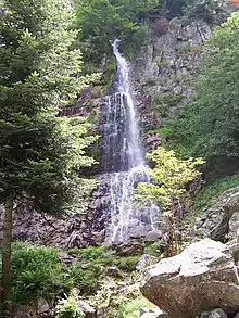 Saut du Gier waterfall | |
Location of La Valla-en-Gier | |
 La Valla-en-Gier  La Valla-en-Gier | |
| Coordinates: 45°25′00″N 4°31′01″E / 45.4167°N 4.5169°E | |
| Country | France |
| Region | Auvergne-Rhône-Alpes |
| Department | Loire |
| Arrondissement | Saint-Étienne |
| Canton | Le Pilat |
| Intercommunality | Saint-Étienne Métropole |
| Government | |
| • Mayor (2020–2026) | Jean-Claude Flachat[1] |
| Area 1 | 34.78 km2 (13.43 sq mi) |
| Population | 1,092 |
| • Density | 31/km2 (81/sq mi) |
| Time zone | UTC+01:00 (CET) |
| • Summer (DST) | UTC+02:00 (CEST) |
| INSEE/Postal code | 42322 /42131 |
| Elevation | 440–1,388 m (1,444–4,554 ft) (avg. 650 m or 2,130 ft) |
| 1 French Land Register data, which excludes lakes, ponds, glaciers > 1 km2 (0.386 sq mi or 247 acres) and river estuaries. | |
La Valla-en-Gier (French pronunciation: [la vala ɑ̃ ʒje]) is a commune in the Loire department in central France.
Population
| Year | Pop. | ±% p.a. |
|---|---|---|
| 1968 | 677 | — |
| 1975 | 581 | −2.16% |
| 1982 | 660 | +1.84% |
| 1990 | 745 | +1.53% |
| 1999 | 741 | −0.06% |
| 2009 | 917 | +2.15% |
| 2014 | 985 | +1.44% |
| 2020 | 1,082 | +1.58% |
| Source: INSEE[3] | ||
See also
References
- ↑ "Répertoire national des élus: les maires". data.gouv.fr, Plateforme ouverte des données publiques françaises (in French). 2 December 2020.
- ↑ "Populations légales 2021". The National Institute of Statistics and Economic Studies. 28 December 2023.
- ↑ Population en historique depuis 1968, INSEE
Wikimedia Commons has media related to La Valla-en-Gier.
This article is issued from Wikipedia. The text is licensed under Creative Commons - Attribution - Sharealike. Additional terms may apply for the media files.