Saint-Thomas-la-Garde | |
|---|---|
Commune | |
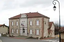 Town hall | |
.svg.png.webp) Coat of arms | |
Location of Saint-Thomas-la-Garde | |
 Saint-Thomas-la-Garde  Saint-Thomas-la-Garde | |
| Coordinates: 45°34′03″N 4°04′53″E / 45.5675°N 4.0814°E | |
| Country | France |
| Region | Auvergne-Rhône-Alpes |
| Department | Loire |
| Arrondissement | Montbrison |
| Canton | Montbrison |
| Intercommunality | CA Loire Forez |
| Government | |
| • Mayor (2020–2026) | Frédéric Pugnet[1] |
| Area 1 | 3.41 km2 (1.32 sq mi) |
| Population | 593 |
| • Density | 170/km2 (450/sq mi) |
| Time zone | UTC+01:00 (CET) |
| • Summer (DST) | UTC+02:00 (CEST) |
| INSEE/Postal code | 42290 /42600 |
| Elevation | 400–546 m (1,312–1,791 ft) (avg. 450 m or 1,480 ft) |
| 1 French Land Register data, which excludes lakes, ponds, glaciers > 1 km2 (0.386 sq mi or 247 acres) and river estuaries. | |
Saint-Thomas-la-Garde (French pronunciation: [sɛ̃ tɔmɑ la ɡaʁd]) is a commune in the Loire department in central France.[3]
Population
| Year | Pop. | ±% p.a. |
|---|---|---|
| 1968 | 221 | — |
| 1975 | 226 | +0.32% |
| 1982 | 451 | +10.37% |
| 1990 | 506 | +1.45% |
| 1999 | 517 | +0.24% |
| 2009 | 583 | +1.21% |
| 2014 | 590 | +0.24% |
| 2020 | 591 | +0.03% |
| Source: INSEE[4] | ||
See also
References
- ↑ "Répertoire national des élus: les maires". data.gouv.fr, Plateforme ouverte des données publiques françaises (in French). 2 December 2020.
- ↑ "Populations légales 2021". The National Institute of Statistics and Economic Studies. 28 December 2023.
- ↑ INSEE commune file
- ↑ Population en historique depuis 1968, INSEE
Wikimedia Commons has media related to Saint-Thomas-la-Garde.
This article is issued from Wikipedia. The text is licensed under Creative Commons - Attribution - Sharealike. Additional terms may apply for the media files.