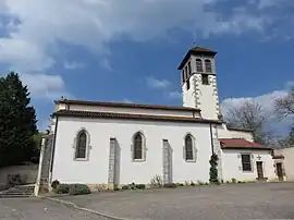
Poncins | |
|---|---|
Commune | |
 | |
.svg.png.webp) Coat of arms | |
Location of Poncins | |
 Poncins  Poncins | |
| Coordinates: 45°43′43″N 4°09′46″E / 45.7286°N 4.1628°E | |
| Country | France |
| Region | Auvergne-Rhône-Alpes |
| Department | Loire |
| Arrondissement | Montbrison |
| Canton | Feurs |
| Government | |
| • Mayor (2020–2026) | Julien Duché[1] |
| Area 1 | 20.63 km2 (7.97 sq mi) |
| Population | 1,218 |
| • Density | 59/km2 (150/sq mi) |
| Time zone | UTC+01:00 (CET) |
| • Summer (DST) | UTC+02:00 (CEST) |
| INSEE/Postal code | 42174 /42110 |
| Elevation | 331–393 m (1,086–1,289 ft) (avg. 330 m or 1,080 ft) |
| 1 French Land Register data, which excludes lakes, ponds, glaciers > 1 km2 (0.386 sq mi or 247 acres) and river estuaries. | |
Poncins (French pronunciation: [pɔ̃sɛ̃]) is a commune in the Loire department in central France.
Geography
The river Lignon du Forez flows through the commune.
Population
| Year | Pop. | ±% p.a. |
|---|---|---|
| 1968 | 579 | — |
| 1975 | 546 | −0.83% |
| 1982 | 632 | +2.11% |
| 1990 | 679 | +0.90% |
| 1999 | 754 | +1.17% |
| 2009 | 869 | +1.43% |
| 2014 | 965 | +2.12% |
| 2020 | 1,168 | +3.23% |
| Source: INSEE[3] | ||
See also
References
- ↑ "Répertoire national des élus: les maires". data.gouv.fr, Plateforme ouverte des données publiques françaises (in French). 2 December 2020.
- ↑ "Populations légales 2021". The National Institute of Statistics and Economic Studies. 28 December 2023.
- ↑ Population en historique depuis 1968, INSEE
Wikimedia Commons has media related to Poncins.
This article is issued from Wikipedia. The text is licensed under Creative Commons - Attribution - Sharealike. Additional terms may apply for the media files.