Les Omergues | |
|---|---|
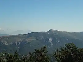 Crête des Serres | |
 Coat of arms | |
Location of Les Omergues | |
 Les Omergues 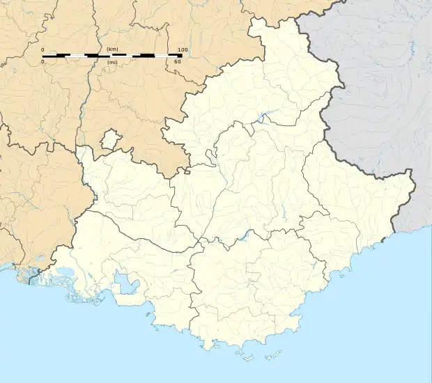 Les Omergues | |
| Coordinates: 44°10′21″N 5°36′30″E / 44.1725°N 5.6083°E | |
| Country | France |
| Region | Provence-Alpes-Côte d'Azur |
| Department | Alpes-de-Haute-Provence |
| Arrondissement | Forcalquier |
| Canton | Sisteron |
| Government | |
| • Mayor (2020–2026) | Alain Coste[1] |
| Area 1 | 34.22 km2 (13.21 sq mi) |
| Population | 128 |
| • Density | 3.7/km2 (9.7/sq mi) |
| Time zone | UTC+01:00 (CET) |
| • Summer (DST) | UTC+02:00 (CEST) |
| INSEE/Postal code | 04140 /04200 |
| Elevation | 789–1,452 m (2,589–4,764 ft) (avg. 820 m or 2,690 ft) |
| 1 French Land Register data, which excludes lakes, ponds, glaciers > 1 km2 (0.386 sq mi or 247 acres) and river estuaries. | |
Les Omergues (French pronunciation: [le.z‿ɔmɛʁɡ]; Occitan: Leis Amèrgues) is a commune in the Alpes-de-Haute-Provence department in southeastern France.
Population
| Year | Pop. | ±% p.a. |
|---|---|---|
| 1968 | 110 | — |
| 1975 | 87 | −3.30% |
| 1982 | 101 | +2.15% |
| 1990 | 65 | −5.36% |
| 1999 | 99 | +4.79% |
| 2009 | 124 | +2.28% |
| 2014 | 131 | +1.10% |
| 2020 | 127 | −0.52% |
| Source: INSEE[3] | ||
See also
References
- ↑ "Répertoire national des élus: les maires". data.gouv.fr, Plateforme ouverte des données publiques françaises (in French). 2 December 2020.
- ↑ "Populations légales 2021". The National Institute of Statistics and Economic Studies. 28 December 2023.
- ↑ Population en historique depuis 1968, INSEE
Wikimedia Commons has media related to Les Omergues.
This article is issued from Wikipedia. The text is licensed under Creative Commons - Attribution - Sharealike. Additional terms may apply for the media files.