Montfuron | |
|---|---|
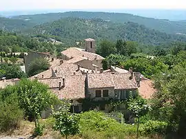 The church and surrounding buildings in Montfuron | |
 Coat of arms | |
Location of Montfuron | |
 Montfuron 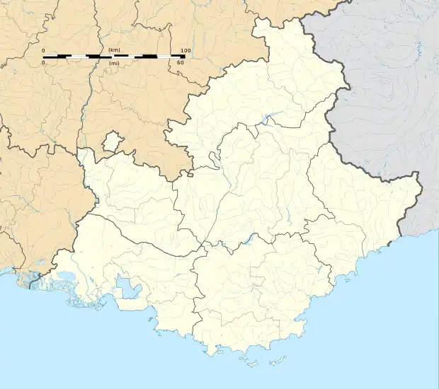 Montfuron | |
| Coordinates: 43°50′12″N 5°41′41″E / 43.8367°N 5.6947°E | |
| Country | France |
| Region | Provence-Alpes-Côte d'Azur |
| Department | Alpes-de-Haute-Provence |
| Arrondissement | Forcalquier |
| Canton | Manosque-1 |
| Intercommunality | Durance-Luberon-Verdon Agglomération |
| Government | |
| • Mayor (2020–2026) | Pierre Fischer[1] |
| Area 1 | 18.88 km2 (7.29 sq mi) |
| Population | 225 |
| • Density | 12/km2 (31/sq mi) |
| Time zone | UTC+01:00 (CET) |
| • Summer (DST) | UTC+02:00 (CEST) |
| INSEE/Postal code | 04128 /04110 |
| Elevation | 373–706 m (1,224–2,316 ft) (avg. 650 m or 2,130 ft) |
| 1 French Land Register data, which excludes lakes, ponds, glaciers > 1 km2 (0.386 sq mi or 247 acres) and river estuaries. | |
Montfuron (French pronunciation: [mɔ̃fyʁɔ̃]) is a commune in the Alpes-de-Haute-Provence department in southeastern France.
Population
| Year | Pop. | ±% p.a. |
|---|---|---|
| 1968 | 86 | — |
| 1975 | 79 | −1.21% |
| 1982 | 156 | +10.21% |
| 1990 | 149 | −0.57% |
| 1999 | 166 | +1.21% |
| 2009 | 197 | +1.73% |
| 2014 | 211 | +1.38% |
| 2020 | 226 | +1.15% |
| Source: INSEE[3] | ||
See also
References
- ↑ "Répertoire national des élus: les maires". data.gouv.fr, Plateforme ouverte des données publiques françaises (in French). 2 December 2020.
- ↑ "Populations légales 2021". The National Institute of Statistics and Economic Studies. 28 December 2023.
- ↑ Population en historique depuis 1968, INSEE
Wikimedia Commons has media related to Montfuron.
This article is issued from Wikipedia. The text is licensed under Creative Commons - Attribution - Sharealike. Additional terms may apply for the media files.