Pommiers-Moulons | |
|---|---|
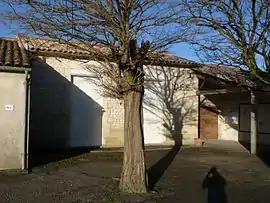 The town hall in Pommiers-Moulons | |
Location of Pommiers-Moulons | |
 Pommiers-Moulons  Pommiers-Moulons | |
| Coordinates: 45°19′30″N 0°21′06″W / 45.325°N 0.3517°W | |
| Country | France |
| Region | Nouvelle-Aquitaine |
| Department | Charente-Maritime |
| Arrondissement | Jonzac |
| Canton | Les Trois Monts |
| Intercommunality | Haute-Saintonge |
| Government | |
| • Mayor (2020–2026) | Hervé Charlassier[1] |
| Area 1 | 9.6 km2 (3.7 sq mi) |
| Population | 214 |
| • Density | 22/km2 (58/sq mi) |
| Time zone | UTC+01:00 (CET) |
| • Summer (DST) | UTC+02:00 (CEST) |
| INSEE/Postal code | 17282 /17130 |
| Elevation | 49–114 m (161–374 ft) (avg. 90 m or 300 ft) |
| 1 French Land Register data, which excludes lakes, ponds, glaciers > 1 km2 (0.386 sq mi or 247 acres) and river estuaries. | |
Pommiers-Moulons (French pronunciation: [pɔmje mulɔ̃]) is a commune in the Charente-Maritime department in southwestern France.
Geography
The Seugne forms most of the commune's northeastern border.
Population
| Year | Pop. | ±% |
|---|---|---|
| 1962 | 262 | — |
| 1968 | 244 | −6.9% |
| 1975 | 226 | −7.4% |
| 1982 | 203 | −10.2% |
| 1990 | 182 | −10.3% |
| 1999 | 174 | −4.4% |
| 2008 | 190 | +9.2% |
See also
References
- ↑ "Répertoire national des élus: les maires". data.gouv.fr, Plateforme ouverte des données publiques françaises (in French). 9 August 2021.
- ↑ "Populations légales 2021". The National Institute of Statistics and Economic Studies. 28 December 2023.
External links
 Media related to Pommiers-Moulons at Wikimedia Commons
This article is issued from Wikipedia. The text is licensed under Creative Commons - Attribution - Sharealike. Additional terms may apply for the media files.