Rouffiac | |
|---|---|
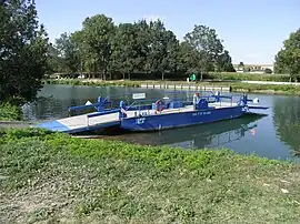 Ferry on the Charente | |
 Coat of arms | |
Location of Rouffiac | |
 Rouffiac  Rouffiac | |
| Coordinates: 45°41′12″N 0°29′21″W / 45.6867°N 0.4892°W | |
| Country | France |
| Region | Nouvelle-Aquitaine |
| Department | Charente-Maritime |
| Arrondissement | Saintes |
| Canton | Thénac |
| Intercommunality | CA Saintes |
| Government | |
| • Mayor (2020–2026) | David Musseau[1] |
| Area 1 | 5.85 km2 (2.26 sq mi) |
| Population | 499 |
| • Density | 85/km2 (220/sq mi) |
| Time zone | UTC+01:00 (CET) |
| • Summer (DST) | UTC+02:00 (CEST) |
| INSEE/Postal code | 17304 /17800 |
| Elevation | 2–27 m (6.6–88.6 ft) |
| 1 French Land Register data, which excludes lakes, ponds, glaciers > 1 km2 (0.386 sq mi or 247 acres) and river estuaries. | |
Rouffiac (French pronunciation: [ʁufjak]) is a commune in the Charente-Maritime department in southwestern France.
Population
| Year | Pop. | ±% p.a. |
|---|---|---|
| 1968 | 364 | — |
| 1975 | 396 | +1.21% |
| 1982 | 359 | −1.39% |
| 1990 | 352 | −0.25% |
| 1999 | 327 | −0.82% |
| 2009 | 468 | +3.65% |
| 2014 | 452 | −0.69% |
| 2020 | 494 | +1.49% |
| Source: INSEE[3] | ||
See also
References
- ↑ "Répertoire national des élus: les maires" (in French). data.gouv.fr, Plateforme ouverte des données publiques françaises. 13 September 2022.
- ↑ "Populations légales 2021". The National Institute of Statistics and Economic Studies. 28 December 2023.
- ↑ Population en historique depuis 1968, INSEE
External links
 Media related to Rouffiac (Charente-Maritime) at Wikimedia Commons
This article is issued from Wikipedia. The text is licensed under Creative Commons - Attribution - Sharealike. Additional terms may apply for the media files.