Sainte-Colombe | |
|---|---|
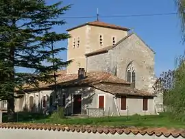 The church in Sainte-Colombe | |
Location of Sainte-Colombe | |
 Sainte-Colombe  Sainte-Colombe | |
| Coordinates: 45°17′02″N 0°16′46″W / 45.2839°N 0.2794°W | |
| Country | France |
| Region | Nouvelle-Aquitaine |
| Department | Charente-Maritime |
| Arrondissement | Jonzac |
| Canton | Les Trois Monts |
| Intercommunality | Haute-Saintonge |
| Government | |
| • Mayor (2020–2026) | Bernard Peruffo[1] |
| Area 1 | 4.38 km2 (1.69 sq mi) |
| Population | 107 |
| • Density | 24/km2 (63/sq mi) |
| Time zone | UTC+01:00 (CET) |
| • Summer (DST) | UTC+02:00 (CEST) |
| INSEE/Postal code | 17319 /17220 |
| Elevation | 75–143 m (246–469 ft) (avg. 125 m or 410 ft) |
| 1 French Land Register data, which excludes lakes, ponds, glaciers > 1 km2 (0.386 sq mi or 247 acres) and river estuaries. | |
Sainte-Colombe (French pronunciation: [sɛ̃t kɔlɔ̃b] ⓘ) is a commune in the Charente-Maritime department in the Nouvelle-Aquitaine region in southwestern France.
Geography
The Seugne forms most of the commune's southwestern border.
Population
| Year | Pop. | ±% |
|---|---|---|
| 1962 | 116 | — |
| 1968 | 139 | +19.8% |
| 1975 | 123 | −11.5% |
| 1982 | 137 | +11.4% |
| 1990 | 120 | −12.4% |
| 1999 | 114 | −5.0% |
| 2008 | 120 | +5.3% |
See also
References
- ↑ "Répertoire national des élus: les maires". data.gouv.fr, Plateforme ouverte des données publiques françaises (in French). 2 December 2020.
- ↑ "Populations légales 2021". The National Institute of Statistics and Economic Studies. 28 December 2023.
External links
 Media related to Sainte-Colombe (Charente-Maritime) at Wikimedia Commons
This article is issued from Wikipedia. The text is licensed under Creative Commons - Attribution - Sharealike. Additional terms may apply for the media files.