Saint-Benoît | |
|---|---|
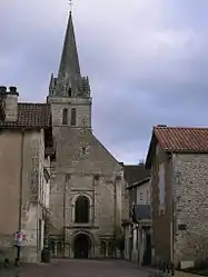 The Abbey of Saint-Benoit | |
 Coat of arms | |
Location of Saint-Benoît | |
 Saint-Benoît  Saint-Benoît | |
| Coordinates: 46°33′02″N 0°20′33″E / 46.5506°N 0.3425°E | |
| Country | France |
| Region | Nouvelle-Aquitaine |
| Department | Vienne |
| Arrondissement | Poitiers |
| Canton | Poitiers-5 |
| Intercommunality | Grand Poitiers |
| Government | |
| • Mayor (2020–2026) | Bernard Peterlongo[1] |
| Area 1 | 13.58 km2 (5.24 sq mi) |
| Population | 7,307 |
| • Density | 540/km2 (1,400/sq mi) |
| Time zone | UTC+01:00 (CET) |
| • Summer (DST) | UTC+02:00 (CEST) |
| INSEE/Postal code | 86214 /86280 |
| Elevation | 72–136 m (236–446 ft) (avg. 80 m or 260 ft) |
| 1 French Land Register data, which excludes lakes, ponds, glaciers > 1 km2 (0.386 sq mi or 247 acres) and river estuaries. | |
Saint-Benoît (French pronunciation: [sɛ̃ bənwa] ⓘ) is a commune in the Vienne department in the Nouvelle-Aquitaine region in western France. It is a southern suburb of Poitiers.
Population
| Year | Pop. | ±% p.a. |
|---|---|---|
| 1968 | 3,881 | — |
| 1975 | 4,889 | +3.35% |
| 1982 | 5,397 | +1.42% |
| 1990 | 5,843 | +1.00% |
| 1999 | 7,008 | +2.04% |
| 2007 | 6,989 | −0.03% |
| 2012 | 7,094 | +0.30% |
| 2017 | 7,233 | +0.39% |
| Source: INSEE[3] | ||
International relations
Saint-Benoît is twinned with:
See also
References
- ↑ "Répertoire national des élus: les maires". data.gouv.fr, Plateforme ouverte des données publiques françaises (in French). 9 August 2021.
- ↑ "Populations légales 2021". The National Institute of Statistics and Economic Studies. 28 December 2023.
- ↑ Population en historique depuis 1968, INSEE
- ↑ "British towns twinned with French towns". Archant Community Media Ltd. Retrieved 2013-07-11.
Wikimedia Commons has media related to Saint-Benoît (Vienne).
This article is issued from Wikipedia. The text is licensed under Creative Commons - Attribution - Sharealike. Additional terms may apply for the media files.