Saint-Savinien | |
|---|---|
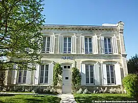 The town hall in Saint-Savinien | |
.svg.png.webp) Coat of arms | |
Location of Saint-Savinien | |
 Saint-Savinien  Saint-Savinien | |
| Coordinates: 45°53′55″N 0°47′13″W / 45.8985°N 0.787°W | |
| Country | France |
| Region | Nouvelle-Aquitaine |
| Department | Charente-Maritime |
| Arrondissement | Saint-Jean-d'Angély |
| Canton | Saint-Jean-d'Angély |
| Government | |
| • Mayor (2020–2026) | Jean-Claude Godineau[1] |
| Area 1 | 47 km2 (18 sq mi) |
| Population | 2,453 |
| • Density | 52/km2 (140/sq mi) |
| Time zone | UTC+01:00 (CET) |
| • Summer (DST) | UTC+02:00 (CEST) |
| INSEE/Postal code | 17397 /17350 |
| Elevation | 0–68 m (0–223 ft) (avg. 6 m or 20 ft) |
| 1 French Land Register data, which excludes lakes, ponds, glaciers > 1 km2 (0.386 sq mi or 247 acres) and river estuaries. | |
Saint-Savinien (French pronunciation: [sɛ̃ savinjɛ̃]) is a commune in the Charente-Maritime department in the Nouvelle-Aquitaine region in southwestern France.[3]
Population
| Year | Pop. | ±% p.a. |
|---|---|---|
| 1968 | 2,377 | — |
| 1975 | 2,342 | −0.21% |
| 1982 | 2,336 | −0.04% |
| 1990 | 2,340 | +0.02% |
| 1999 | 2,359 | +0.09% |
| 2007 | 2,372 | +0.07% |
| 2012 | 2,456 | +0.70% |
| 2017 | 2,433 | −0.19% |
| Source: INSEE[4] | ||
History
Saint-Savinien-sur-Charente is one of the most picturesque communes in Roman Saintonge. It dates back to the Roman times.
Sights
- Château de la Cave
See also
References
- ↑ "Répertoire national des élus: les maires". data.gouv.fr, Plateforme ouverte des données publiques françaises (in French). 2 December 2020.
- ↑ "Populations légales 2021". The National Institute of Statistics and Economic Studies. 28 December 2023.
- ↑ Commune de Saint-Savinien (17397), INSEE
- ↑ Population en historique depuis 1968, INSEE
External links
 Media related to Saint-Savinien at Wikimedia Commons
This article is issued from Wikipedia. The text is licensed under Creative Commons - Attribution - Sharealike. Additional terms may apply for the media files.