Bresse Vallons | |
|---|---|
Commune | |
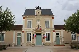 Town hall in Cras-sur-Reyssouze | |
Location of Bresse Vallons | |
 Bresse Vallons  Bresse Vallons | |
| Coordinates: 46°18′33″N 5°09′59″E / 46.3092°N 5.1664°E | |
| Country | France |
| Region | Auvergne-Rhône-Alpes |
| Department | Ain |
| Arrondissement | Bourg-en-Bresse |
| Canton | Attignat |
| Intercommunality | CA Bassin de Bourg-en-Bresse |
| Government | |
| • Mayor (2020–2026) | Virginie Grignola-Bernard[1] |
| Area 1 | 25.98 km2 (10.03 sq mi) |
| Population | 2,380 |
| • Density | 92/km2 (240/sq mi) |
| Time zone | UTC+01:00 (CET) |
| • Summer (DST) | UTC+02:00 (CEST) |
| INSEE/Postal code | 01130 /01340 |
| Elevation | 195–229 m (640–751 ft) |
| 1 French Land Register data, which excludes lakes, ponds, glaciers > 1 km2 (0.386 sq mi or 247 acres) and river estuaries. | |
Bresse Vallons is a commune in the Ain department in eastern France. It is the result of the merger, on 1 January 2019, of the communes of Cras-sur-Reyssouze and Étrez.[3]
Population
| Year | Pop. | ±% p.a. |
|---|---|---|
| 1968 | 1,077 | — |
| 1975 | 1,091 | +0.18% |
| 1982 | 1,312 | +2.67% |
| 1990 | 1,356 | +0.41% |
| 1999 | 1,549 | +1.49% |
| 2007 | 1,886 | +2.49% |
| 2012 | 2,164 | +2.79% |
| 2017 | 2,282 | +1.07% |
| Populations of the area corresponding with the commune of Bresse Vallons at 1 January 2020. Source: INSEE[4] | ||
See also
References
Wikimedia Commons has media related to Bresse Vallons.
- ↑ "Répertoire national des élus: les maires" (in French). data.gouv.fr, Plateforme ouverte des données publiques françaises. 13 September 2022.
- ↑ "Populations légales 2021". The National Institute of Statistics and Economic Studies. 28 December 2023.
- ↑ Arrêté préfectoral Archived 17 January 2021 at the Wayback Machine (in French)
- ↑ Population en historique depuis 1968, INSEE
This article is issued from Wikipedia. The text is licensed under Creative Commons - Attribution - Sharealike. Additional terms may apply for the media files.