Brucourt | |
|---|---|
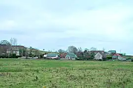 A general view of Brucourt | |
 Coat of arms | |
Location of Brucourt | |
 Brucourt  Brucourt | |
| Coordinates: 49°14′47″N 0°05′57″W / 49.2464°N 0.0992°W | |
| Country | France |
| Region | Normandy |
| Department | Calvados |
| Arrondissement | Lisieux |
| Canton | Cabourg |
| Government | |
| • Mayor (2020–2026) | Marie-Louise Besson[1] |
| Area 1 | 6.6 km2 (2.5 sq mi) |
| Population | 127 |
| • Density | 19/km2 (50/sq mi) |
| Time zone | UTC+01:00 (CET) |
| • Summer (DST) | UTC+02:00 (CEST) |
| INSEE/Postal code | 14110 /14160 |
| Elevation | 2–105 m (6.6–344.5 ft) (avg. 4 m or 13 ft) |
| 1 French Land Register data, which excludes lakes, ponds, glaciers > 1 km2 (0.386 sq mi or 247 acres) and river estuaries. | |
Brucourt (French pronunciation: [bʁykuʁ] ⓘ) is a commune in the Calvados department in the Normandy region in northwestern France.
Population
| Year | Pop. | ±% p.a. |
|---|---|---|
| 1968 | 114 | — |
| 1975 | 84 | −4.27% |
| 1982 | 107 | +3.52% |
| 1990 | 108 | +0.12% |
| 1999 | 120 | +1.18% |
| 2009 | 133 | +1.03% |
| 2014 | 123 | −1.55% |
| 2020 | 126 | +0.40% |
| Source: INSEE[3] | ||
See also
References
- ↑ "Répertoire national des élus: les maires". data.gouv.fr, Plateforme ouverte des données publiques françaises (in French). 9 August 2021.
- ↑ "Populations légales 2021". The National Institute of Statistics and Economic Studies. 28 December 2023.
- ↑ Population en historique depuis 1968, INSEE
Wikimedia Commons has media related to Brucourt.
This article is issued from Wikipedia. The text is licensed under Creative Commons - Attribution - Sharealike. Additional terms may apply for the media files.