Démouville | |
|---|---|
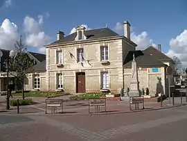 The town hall in Démouville | |
.svg.png.webp) Coat of arms | |
Location of Démouville | |
 Démouville  Démouville | |
| Coordinates: 49°10′54″N 0°16′03″W / 49.1817°N 0.2675°W | |
| Country | France |
| Region | Normandy |
| Department | Calvados |
| Arrondissement | Caen |
| Canton | Troarn |
| Intercommunality | CU Caen la Mer |
| Government | |
| • Mayor (2020–2026) | Ludovic Robert[1] |
| Area 1 | 3.56 km2 (1.37 sq mi) |
| Population | 3,008 |
| • Density | 840/km2 (2,200/sq mi) |
| Time zone | UTC+01:00 (CET) |
| • Summer (DST) | UTC+02:00 (CEST) |
| INSEE/Postal code | 14221 /14840 |
| Elevation | 13–29 m (43–95 ft) (avg. 19 m or 62 ft) |
| 1 French Land Register data, which excludes lakes, ponds, glaciers > 1 km2 (0.386 sq mi or 247 acres) and river estuaries. | |
Démouville (French pronunciation: [demuvil] ⓘ) is a commune in the Calvados department in the Normandy region in northwestern France.
Population
| Year | Pop. | ±% p.a. |
|---|---|---|
| 1968 | 1,045 | — |
| 1975 | 1,373 | +3.98% |
| 1982 | 2,165 | +6.72% |
| 1990 | 2,495 | +1.79% |
| 1999 | 3,052 | +2.26% |
| 2007 | 3,153 | +0.41% |
| 2012 | 3,297 | +0.90% |
| 2017 | 3,189 | −0.66% |
| Source: INSEE[3] | ||
See also
References
- ↑ "Répertoire national des élus: les maires". data.gouv.fr, Plateforme ouverte des données publiques françaises (in French). 9 August 2021.
- ↑ "Populations légales 2021". The National Institute of Statistics and Economic Studies. 28 December 2023.
- ↑ Population en historique depuis 1968, INSEE
Wikimedia Commons has media related to Démouville.
This article is issued from Wikipedia. The text is licensed under Creative Commons - Attribution - Sharealike. Additional terms may apply for the media files.